Observation: Whitney Basin

Observation Date
3/26/2022
Observer Name
Ted Scroggin
Region
Uintas » Whitney Basin
Location Name or Route
Whitney Basin
Weather
Sky
Few
Wind Direction
Southwest
Wind Speed
Light
Weather Comments
Amazing weather with what feels more like late April or May. It's a little depressing and concerning watching the winter quickly start to fade with the trailhead all but gone and patches of highway are melting through. It was nearly 60 degrees today and the snow conditions are taking a big hit.
Snow Characteristics
Snow Surface Conditions
Melt-Freeze Crust
Damp
Snow Characteristics Comments
Not much of a freeze last night and the snow conditions quickly softened today and the riding and turning went from kind of supportable, to not supportable at all in just a short period of time. Much of the snow that I was finding was a melt freeze crust with soft snow very limited and in protected areas.
Red Flags
Red Flags
Rapid Warming
Poor Snowpack Structure
Red Flags Comments
Although I was not seeing a lot of wet activity around the Whitney area, the rapid warm temperatures and unsupportable snow was a red flag for me. There was some good wet debris piles on the west side of Moffit Peak and roller balls on the south half of the compass were common.
Avalanche Problem #1
Problem
Persistent Weak Layer
Trend
Same
Problem #1 Comments
Around the mid elevation zone it is easy to locate the buried weak sugary snow from the dry spell we had in January and February. Where I dug today it took some hard hits on the shovel to get a crack to propagate, but it is amazing how this weak layer is still so well developed and easy to locate. I'm not sure what the hazard is, but with so much uncertainity how this snow pack will handle the warm spring like conditions.
Avalanche Problem #2
Problem
Wet Snow
Trend
Increasing Danger
Problem #2 Comments
Not a lot of wet activity that I observed today, but the snow pack is getting some intense sunshine.
Comments
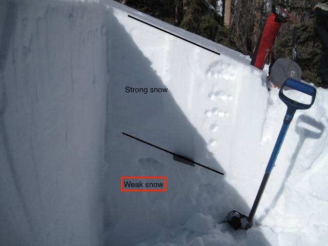
1. A quick snow pit on a east to northeast facing slope just below 10,000' in a somewhat protected area revealed how well developed and preserved the weak sugary snow is below the past few storms.
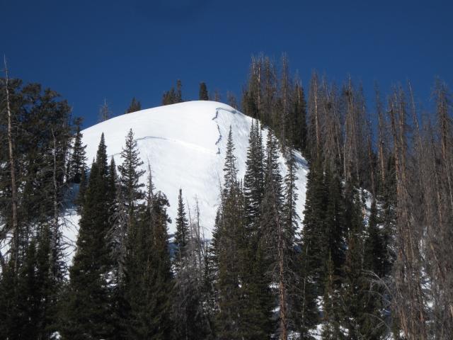
2. This avalanche possibly a week old was likely remotely triggered from the bottom of the slope or around the corner. It is a northeast facing slope around 10,000' and looks to have broken into the old faceted snow.
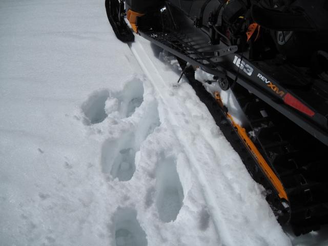
1. By mid morning I was already punching through the snow as I stepped off the sled on a southeast facing slope. The overnight freeze is very shallow and snow conditions are softening quickly.
2. The trailhead and road conditions are taking a big hit with these very warm temperatures.
Today's Observed Danger Rating
Considerable
Tomorrows Estimated Danger Rating
Considerable
Coordinates