
Observation Date
3/23/2022
Observer Name
Champion
Region
Salt Lake » Big Cottonwood Canyon » Cardiff/Mineral
Location Name or Route
Georges Bowl to East Mineral
Comments
Headed out to check out how warm the snow surfaces were becoming, and get a look at the upper elevation West/Northwest facing snowpack. The temperatures were warm from the start, and much of the road is melted out getting into Cardiff. Once on the road, the snow surface would transition between damp and dry depending on the shade. Made for some sticky skins in the beginning. Once we began traveling up Georges Bowl, the snow surface remained generally cold until you hit any small terrain features that pointed true south. We did not see any roller balls, or pinwheels while traveling uphill.
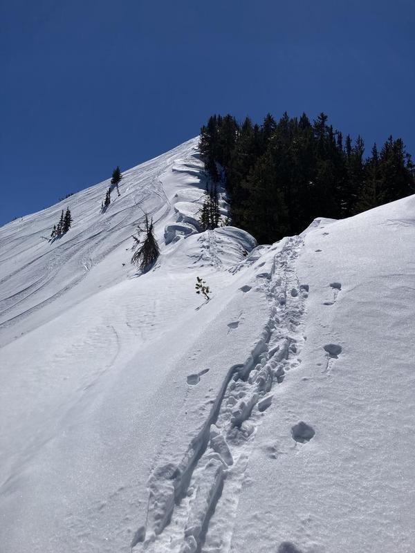
On the Cardiff/Mineral ridgeline, there were medium-sized corniced formed. While these cornices have likely formed over the last few days of elevated winds, once we were on the ridgeline there was no obvious transport occurring, and the cornices didn't seem to be growing in any fashion.
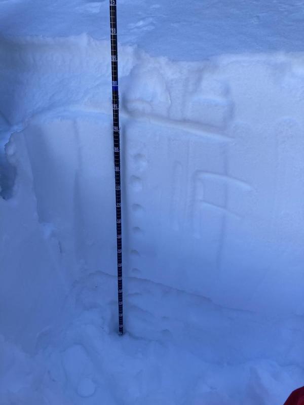
Near the top of the East Fork of Mineral, I was able to poke onto a west-northwest facing aspect and get a better look at the snowpack structure. At 10,130' the total snowpack depth was 205cm. There was about 10cm of soft, fist-hard settled powder sitting atop of 50cm of 1 finger hard decomposing precip particles and rounds. That 60cm of snow sat atop of 4f+ facets that went down as far as I dug. While the poor snowpack structure does still exist on this aspect, I was unable to get any propagation within my pit. While we don't have a ton of data points from the more westerly facing aspects, one more pit on a more westerly facing slope without propagation would lead me to believe the likelihood of triggering an avalanche within the PWL is becoming lower on that aspect than aspects facing true north to east. This doesn't mean impossible, it may just help us narrow in the areas of higher liklihood and consequence.
The snow remained cold and soft in shaded north-facing terrain, and only began heavily sticking when we got onto sunlit slopes. The out track was fast in the shade, and slow in the sun. The mineral approach is melting out rapidly.
Photo of the snowpit in Upper East Fork of Mineral.
Photos of the corniced ridgeline and recent activity across into Upper Mineral Fork.
Today's Observed Danger Rating
Moderate
Tomorrows Estimated Danger Rating
Moderate
Coordinates


