Join us at our 2nd Annual Blizzard Ball

Observation: Gold Basin

Observation Date
3/3/2022
Observer Name
Garcia, Ament
Region
Moab » Gold Basin
Location Name or Route
Gold Basin, Red Snow Cirque
Weather
Sky
Broken
Wind Direction
Southwest
Wind Speed
Light
Snow Characteristics
Snow Surface Conditions
Powder
Dense Loose
Melt-Freeze Crust
Snow Characteristics Comments
The snow is holding up on northerly aspects. We skied medium density powder in open north facing terrain.
Red Flags
Red Flags
Cracking
Collapsing
Poor Snowpack Structure
Red Flags Comments
We had some collapsing today with associated shooting cracks. Most of the collapsing was on relatively flat terrain with no aspect. The collapsing is worth mentioning, but we really didn't get collapsing on anything with some slope angle or real aspect. A more pertinent Ob is that we stomped around on some steep NE facing rollovers in the GB Moraines with no results. We saw poor snowpack structure in a North facing pit at 10,460 Ft.
Avalanche Problem #1
Problem
Persistent Weak Layer
Trend
Decreasing Danger
Problem #1 Comments
Buried facets are still a concern beneath last week's storm snow. They are about 35 cm beneath the surface and easy to find. We took the path less traveled up towards Tele Heaven to walk on some untouched snow to see if anything would collapse or crack. We walked on top of and across some steep NE facing rollovers. No results to speak of around the Gold Basin Moraines. We dug a North facing pit at 10,460 ft and performed some stability tests, we got an ECTX. This layer is less reactive than it was just a few days ago, but it is worth paying attention to this weekend when the storm moves in. The Friday system looks small and may not be enough to overburden this weak layer, but the bigger shot of snow Saturday into Sunday just may be enough to produce some avalanches on these facets. Time will tell.
Avalanche Problem #2
Problem
Wet Snow
Trend
Decreasing Danger
Problem #2 Comments
It was another warm day, but we had some cloud cover to keep things cooler. I saw no signs of wet avalanche activity today. Tomorrow the temps will drop and snow will start to fall. We can drop this problem type for tomorrow's advisory.
Snow Profile
Aspect
North
Elevation
10,400'
Slope Angle
28°
Video
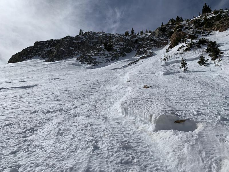
Photo 1: A look at the old crowns in Tele Gold that ran during the last storm cycle.
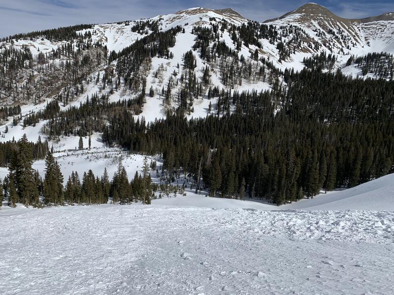
Photo 2: Tele Gold debris pile. Also a good look at the solar aspects across the canyon, they are melting out quickly.
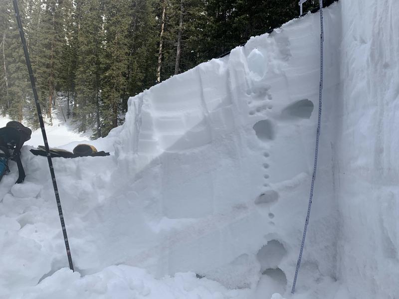
Photo 3: This photo of our pit wall is useful for better understanding the included snow profile.
Today's Observed Danger Rating
Moderate
Tomorrows Estimated Danger Rating
Moderate
Coordinates