Fall Auction is now live! Check it out now

Observation: UFO Bowls

Observation Date
2/28/2022
Observer Name
Meisenheimer
Region
Provo » American Fork » UFO Bowls
Location Name or Route
Aspen Grove to UFO Bowls (draft)
Weather
Sky
Clear
Weather Comments
Clear and sunny. No wind. At noon, the mountain temperature was 43 °F when I arrived in the Aspen Grove (6,880') parking lot.
Snow Characteristics
New Snow Depth
7"
New Snow Density
Medium
Snow Surface Conditions
Powder
Faceted Loose
Wind Crust
Melt-Freeze Crust
Damp
Snow Characteristics Comments
Just a few inches of new snow in the Aspen Grove parking lot that was wet and manky. I made my way up to roughly 8,800; in elevation, and here I found approximately 20 cm (7.8 inches) of new snow. See pit picture. At almost all elevations in the shade, the new snow remains cold, dry powder. The sun took its toll on the sun-exposed terrain, and I would expect everything from southeast, south, and west facing terrain to be crusted in the morning.
Red Flags
Red Flags
Rapid Warming
Poor Snowpack Structure
Red Flags Comments
The wet snow issues on the southern half of the compass seemed well behaved with only minor natural wet loose avalanche activity. On the north half of the compass, we should focus our attention on the weak faceted snow now buried and preserved 6-8 inches under the new snow.
Avalanche Problem #1
Problem
Wet Snow
Problem #1 Comments
The mountains went through a small wet loose avalanche cycle within the past couple of days of direct sunlight and warm temperatures. It looked to me the wet snow avalanches were confined to the new snow and ran on top of old sun crusts (see pic 1).
Avalanche Problem #2
Problem
Persistent Weak Layer
Problem #2 Comments
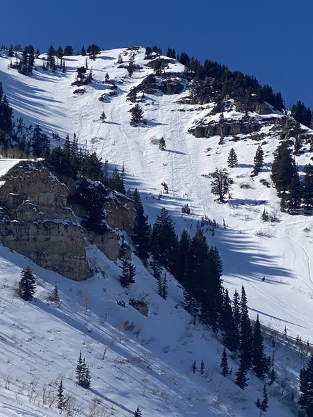
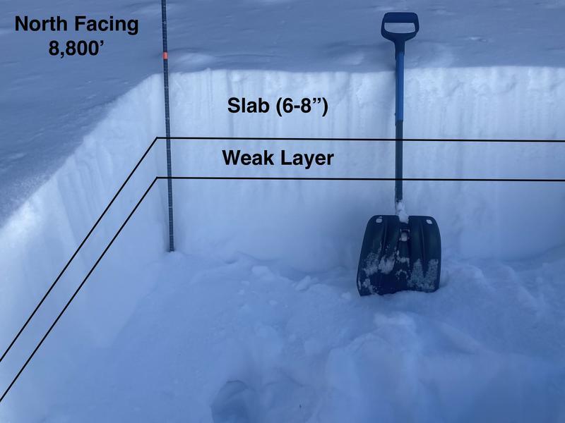
The January/February dry spell took its toll on our snowpack, especially on the shady mid and upper elevation slopes. Snow on 2/16 & 2/17 preserved the weak layer, and snow on 2/22 through 2/25 started building the slab. Currently, in the Provo area, we have roughly 6-8" of settled snow above a very loose and faceted weak layer. This new snow above the weak layer is all of February's snowfall.
I don't think the 6-8" of new snow that sits above this weak layer is much of an issue now (unless you're on a wind-loaded slope). The bad news is the 6-8 inches of new snow buried and preserved this weak layer. The even worse news is once we get a large enough load, we will see a significant avalanche cycle on this layer. However, that will all depend on snow and water amounts in March. For now, it seems there is not enough weight on top of this layer to be much of a concern (see pic 2).
Video
Today's Observed Danger Rating
Moderate
Tomorrows Estimated Danger Rating
None
Coordinates