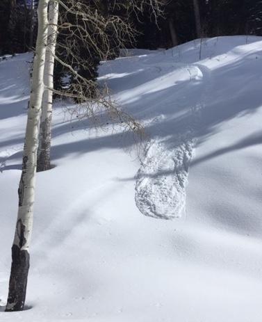
Saturday found some areas becoming fairly feathered. Almost certainly ripped away by the end of the day Sunday, as the wind was strong on the ridges and swirling down low in northwest drainages. Dug Saturday on direct north face at 8,670' 30 degree slope, total depth 140cm. Top 10 cm from recent storm, next 10 cm sugar, then solid 4F to 1F all the way to the ground. Was looking for a crust, but there was none that I could find in that spot. Hit short steep north pitches and could get nothing to move. Anything slightly west facing was breakable crust. On exit Saturday at 5 P.M., anything not directly north or in the shade of big pines had become damp. Similar area Sunday, was able to find good settled powder in direct north, but even the slightest tilt to the west northwest presented crust. Managed to get a small slough Sunday on a west northwest pitch steeper than 35 at 9,250.