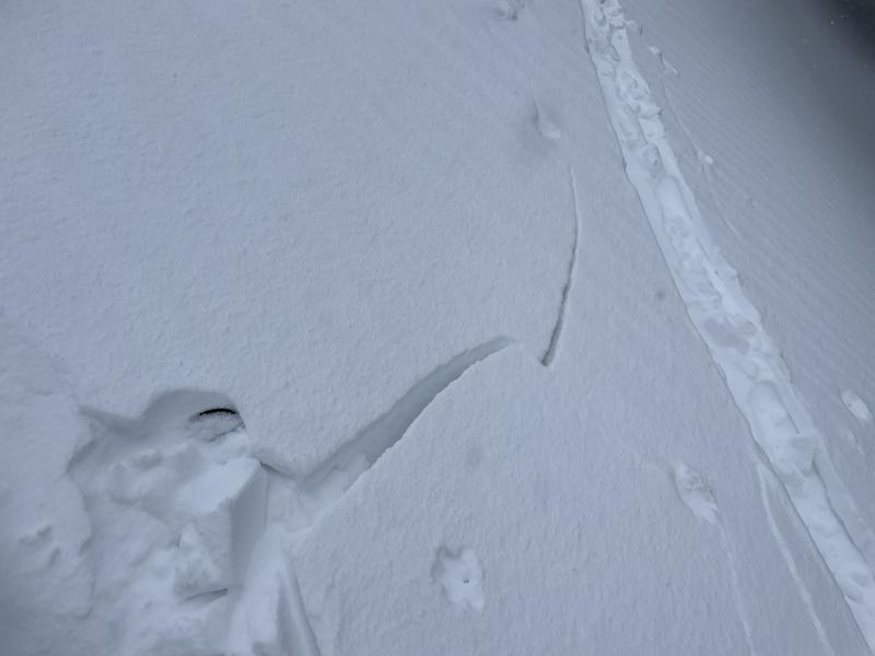
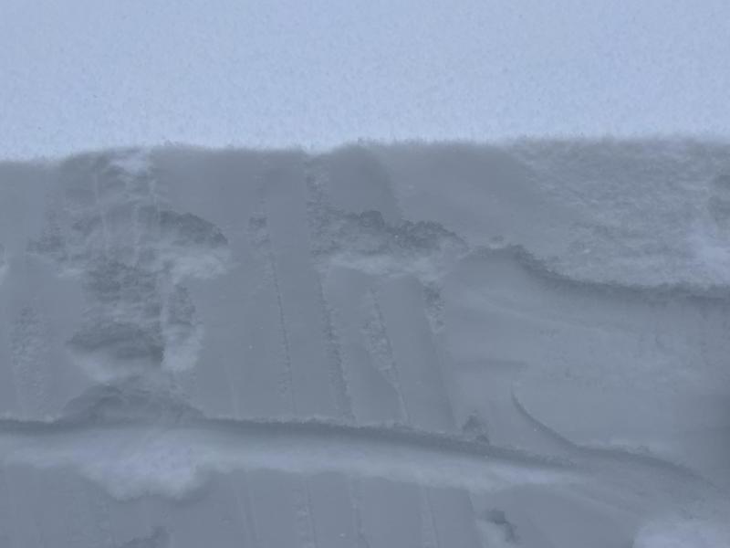
New snow is around 10-20 cm deep depending on where you look as of 1300 Weds 1/5. The new snow is falling on a much less dense (F) snow which is a classic example of a density inversion within the new/old snow interface. New snow has rapidly consolidated into a slab due to high humidity and moisture content. I would suspect this new layer to be very reactive on solar slopes where a bed surface is more pronounced E/SE/S/SW especially on convex/unsupported slopes. I only tested northerly half slopes which indicated poor stability in shear tests so anything else is presumptive. With new snow on top of this especially on easterly slopes where wind has deposited more snow, this isn't going to be headline grabbing in terms of sizes of slides, but certainly considerable enough to cause harm to humans. It should not outlive the storm all that much, but definitely isn't going anywhere overnight. In this case S facing slopes are not a bastion of safety as have been touted in the last couple weeks.
This always concerns me because everyone is hyper focused on the persistent weak layer that dominates the talking points that it's very easy to get caught off guard by the other avalanche problems that still exist. As of now this isn't gravely concerning, but with 12" more snow on top, it could definitely prove to be more threatening.