Observation Date
12/28/2021
Observer Name
Bill Nalli
Region
Uintas » Upper Weber Canyon
Location Name or Route
Upper Weber Canyon
Comments
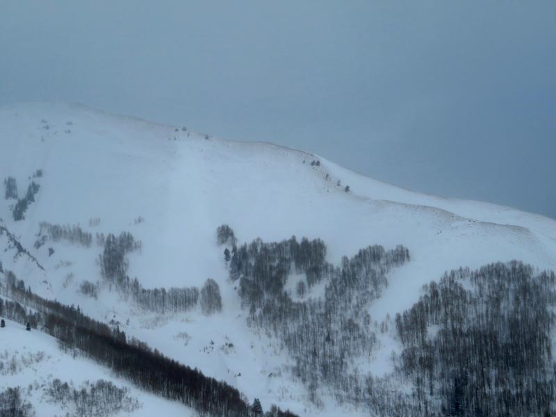
Above treeline, the strong winds have stripped exposed S through W facing ridgelines bare and created slabs on the E thru N to NW facing slopes along with cross loaded gullies.
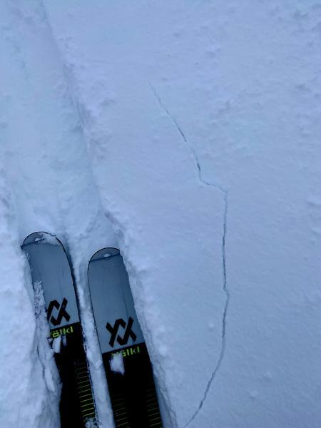
Localized cracking in wind drifted snow was observed failing about 40cm below the surface at a density change in the storm snow.
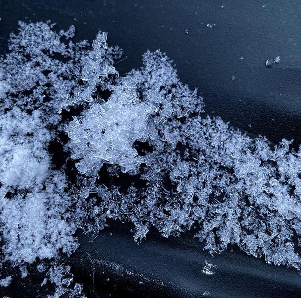
Stability analysis is really a tale of two snowpacks. Where there is old snow from October there is now a significant persistent weak layer at the ground. This exists near and above treeline on E though N to NW aspects. Where the slopes were bare ground prior to the Christmas storm cycle the snowpack is mostly right-side up, stable, storm snow. This exists on the sunny aspects at all elevations and most all aspects below treeline. Two snowpits dug today in near treeline terrain highlight this dichotomy. The more stable pit on an aspect just south of due east and the less stable pit more due east. In the less stable pit, an ECTP 12 screams out at you to avoid terrain with this structure. Pic 3 is of the 4mm clustered depth hoar that will be our primary layer of concern for the forseeable future.


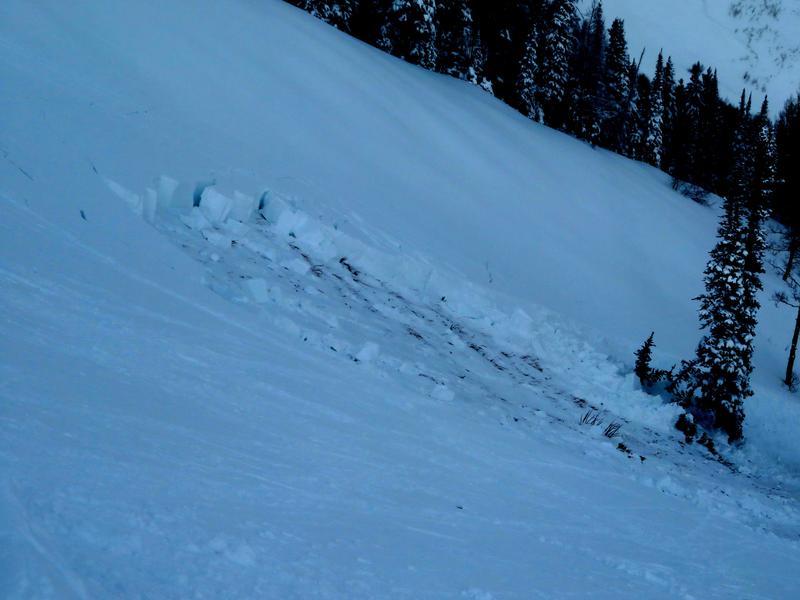
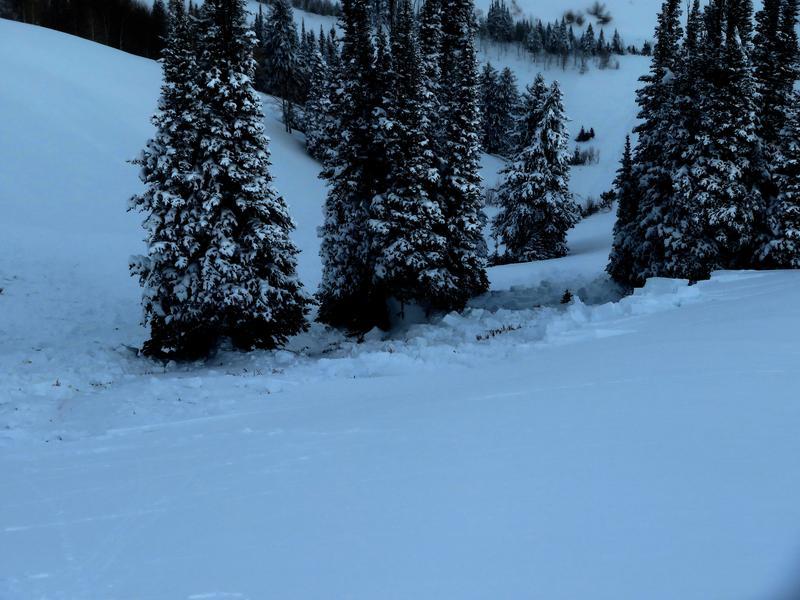
With more time since the major loading event, the snowpack has continued to adjust to the new load and is less sensitive. Fewer obvious signs of instability are present but don't be fooled with the lack of bulls-eye data. This last image is of an explosive controlled R1-D2 avalanche at 9600' on an E aspect. It was 3' deep and 150' wide failing in the 4mm depth hoar at the ground. The entire slope cracked and failed but only a small portion of the slope avalanched about 200' from the shot below the ridge. It highlights the tricky nature of this PWL and is a reminder that advanced facets rarely behave as you would expect them too and should be given extra respect.
Today's Observed Danger Rating
Considerable
Tomorrows Estimated Danger Rating
Considerable


