
Observation Date
12/14/2021
Observer Name
Champion & Thayer
Region
Salt Lake » Little Cottonwood Canyon » Catherine's Pass
Location Name or Route
Catherines Pass
Comments
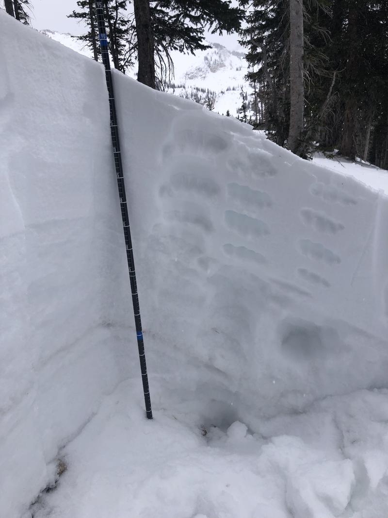
Primarily wanted to get out and look at the variable snow surfaces, and test the stability of the weak faceted snow before this next storm system moves in. While walking around, the snow surface was either firm wind board or settled powder from last week - with very little in between. While we didn't get any obvious signs of instability, such as cracking or collapsing, as soon as we stuck our shovels in the snow the weak faceted snow came pouring out of the pit walls.
We dug a quick pit on an NW aspect at 9900' just below Catherine's Pass. Within that pit, we got an extended column test to propagate (ECTP13) down 35cm on the faceted grains just below last week's new snow. While the new snow has settled for a few days, and we have not been seeing as much activity within the new snow itself, or on the old faceted snow, this does not mean that the stability of the grains has improved. The old October and November snow are very loose and faceted along the entirety of the upper elevation northerly aspects, and once we continue to add more snow and high winds the avalanche danger will only increase. Moving into tomorrow, with the increased load I would expect to see a tipping point in these weak grains, and the avalanche activity to pick up again.
Hand Hardness of the Pit Profile from NW Aspect at 9990' below Catherines Pass, Upper LCC.
Video
Today's Observed Danger Rating
Considerable
Tomorrows Estimated Danger Rating
High
Coordinates


