Observation: Moab

Observation Date
12/13/2021
Observer Name
Charlie Ramser
Region
Moab
Location Name or Route
Laurel Highway
Weather
Sky
Scattered
Wind Direction
Southwest
Wind Speed
Moderate
Weather Comments
The wind was the primary weather we observed today. Mostly clear skies and it warmed up into the 30's. Wind was consistently moderate with some strong gusts.
Snow Characteristics
Snow Surface Conditions
Powder
Wind Crust
Rain-Rime Crust
Snow Characteristics Comments
Wind crust and wind transported snow covered much of the terrain traveled on today. It was generally more wind buff than a firm wind crust. There was still soft powdery snow in protected areas, it was settled and could be described as medium to high denisty powder. Pretty fun snow sliding conditions!
Red Flags
Red Flags
Recent Avalanches
Wind Loading
Collapsing
Poor Snowpack Structure
Red Flags Comments
There was so much apparent wind loading, I was eyeing recent avalanches to see if there had been any repeats or new slab development since they slid. This was not the case. However, the wind loading has continued to be significant. We did find pockets where collapsing occurred, off the road or skin track where the storm snow buried the October facets. Poor structure - weak layer and cohesive storm snow above.
Avalanche Problem #1
Problem
Persistent Weak Layer
Trend
Same
Problem #1 Comments
Our longer term histroy and our long term problem. From town, I've been watching the snow from October wither away slowly, but it has remained just enough...
The facets that got burried are as big and problematic as we've feared. Striations, corners, cups, maybe 2mm.
This will likely be the broken record of our avy forecast for a while.
Avalanche Problem #2
Problem
Wind Drifted Snow
Trend
Same
Problem #2 Comments
A shorter term history to some shorter term problems. So much snow has blown around since Friday. I don't always see obvious signs of wind loading on the Laurel Highway even when there are high winds in the La Sals. This event, however, is different. There is 20+ cm of wind drifted snow sitting on top of the storm snow on the Pre Laurel Ridge, a sizeable cornice that has formed on the Tuk No NW ridge, pockets that have been wind scoured and are bare ground, and recent tracks filled in. All snow surfaces that aren't well protected by trees are textured and wind affected.
Ski penetrations vary from 4-10cm in wind affected areas.
I noted the trend of 'same' due to continued winds in the forecast.
Comments
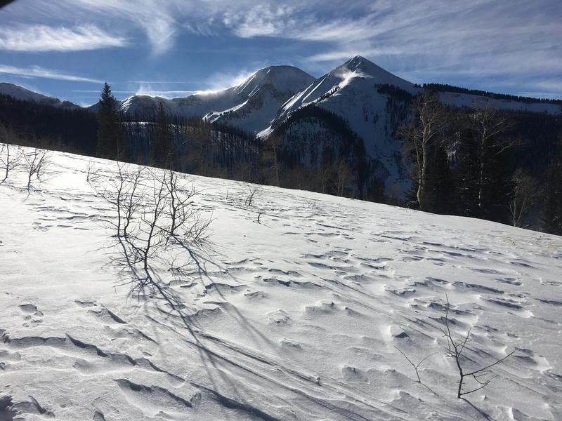
Wow! Since Friday so much has happened in the mountains. Two feet of right side up snow that made for better than expected riding and travel conditions, widespread wind trasnporting, a rime event, and avalanches. It was humbling to see how much can happen in the mountains in such a small time with almost no prior snowpack.
Today's Observed Danger Rating
Considerable
Tomorrows Estimated Danger Rating
Considerable
Coordinates