Observation Date
3/22/2021
Observer Name
Davis
Region
Uintas » Gold Hill
Location Name or Route
North Slope-Gold Hill
Weather
Sky
Scattered
Wind Speed
Calm
Weather Comments
The air was cold this am at the Bear river service (11F), but the skys were clear, initially, and the winds were calm. As the sun rose the temps increased to the low 20's and the clouds started to roll in the from the west by about noon. As per todays weather report it looked like some light snow showers were starting to develop as we exited the area at about 1pm.
Snow Characteristics
New Snow Depth
12"
New Snow Density
Low
Snow Surface Conditions
Powder
Snow Characteristics Comments
Snow in the lower elevations appeared to be about 6 to 8" with a solid bottom. However, as we continued our climb we found some good powdery snow in north facing shaded slopes/trees. At about 10k new snow depths are easily 18" or better in sheltered areas.
Red Flags
Red Flags
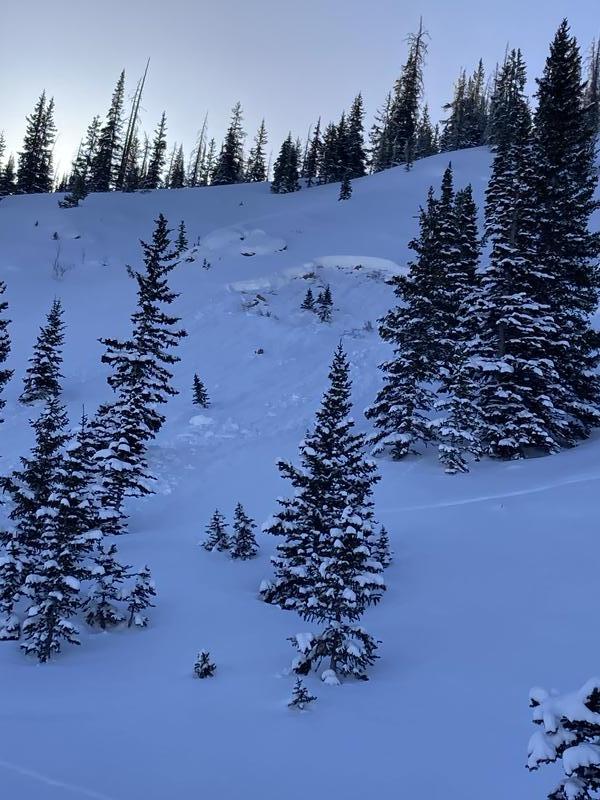
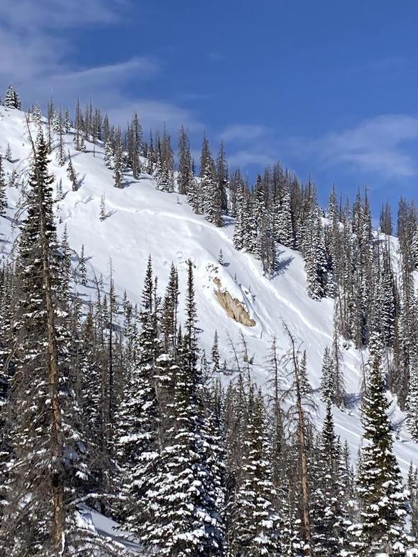
Recent Avalanches
Wind Loading
Avalanche Problem #1
Problem
Wind Drifted Snow
Trend
Same
Problem #1 Comments
We spotted two avalanches on Gold Hill. One appeared to be a few days old and I am not sure of how it was triggered. Could have been wind loading or sledders high marking leading into the weekend. The second appeared to be much smaller, fresh from Sunday and triggered by a snowmobile on a small rock band.
Snow Profile
Aspect
North
Elevation
9,800'
Slope Angle
28°
Comments
Snowpit was unreactive to stability tests. However, that doesn't mean an avi cant happen. Wind loaded steep slopes could still prove to be problematic if triggered.
Today's Observed Danger Rating
Moderate
Tomorrows Estimated Danger Rating
Moderate
Coordinates