Join us at our 2nd Annual Blizzard Ball

Observation: Hogum

Observation Date
3/18/2021
Observer Name
CBrown
Region
Salt Lake » Little Cottonwood Canyon » Hogum
Location Name or Route
LCC-Red Pine-Maybird-Hogum
Weather
Sky
Scattered
Wind Direction
South
Wind Speed
Light
Weather Comments
Warm temps, light winds from the south
Snow Characteristics
Snow Surface Conditions
Powder
Dense Loose
Wind Crust
Melt-Freeze Crust
Damp
Snow Characteristics Comments
Souths, low angle norths and all aspects low elev had moist warm snow. Cold recrystallized shallow powder on upper/mid elev norths. Mid elev norths were a little warm.
Red Flags
Red Flags
Recent Avalanches
Rapid Warming
Red Flags Comments
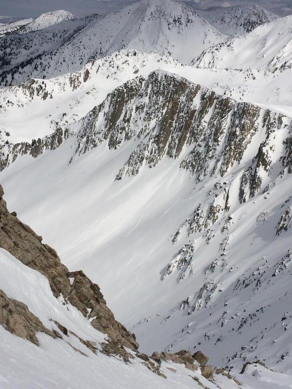
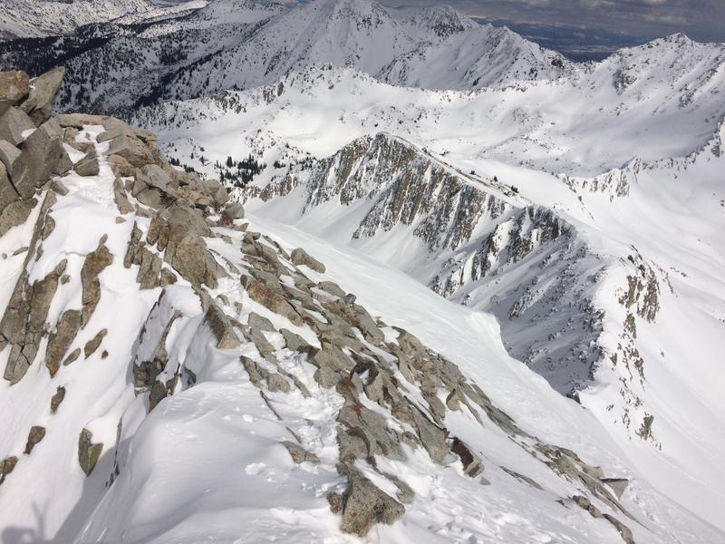
Not much AST today with things on most aspects locked up. Watched natural avalanching taking place on NW, and S-SW-S around 15:00. Steep NW 10,900 in the Maybird headwall WL/roller balling over running a skin track from earlier. Natural avalanching on moderate angle SW at 11,200-10,800 and WL-ASc-R2-D1.5/2 11,200-10,900 South. Slow moving DL on steep north facing slopes 11,200-10,200
Avalanche Problem #1
Problem
Wet Snow
Trend
Increasing Danger
Problem #1 Comments
Surprised by the natural activity and the amount entrained off of skis. Also surprised to see natural activity on the NW upper elev slopes. Expect similar tomorrow or less with winds forecasted to be slightly higher, temps look potentially warmer.
Avalanche Problem #2
Problem
New Snow
Trend
Same
Problem #2 Comments
Not new storm problem but there is dry loose on upper elev steep norths that entrain the available powder on longer slopes.
Comments
Picture 1-2 natural WL on NW on Maybird headwall, picture 3 of WL on S-SW-W
Today's Observed Danger Rating
None
Tomorrows Estimated Danger Rating
None