
Observation Date
2/28/2021
Observer Name
Staples
Region
Uintas » Upper Weber Canyon » Middle Fork Weber River
Location Name or Route
Middle Fork of Weber River
Comments
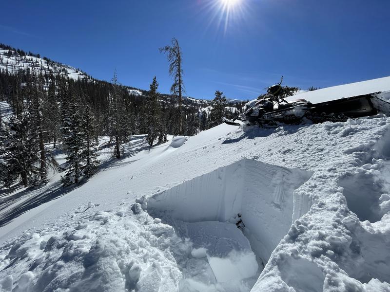
Photo below of shooting cracks 20-30 feet from the sled. The snowpack was only about 2 feet deep here. We did not see cracking anywhere else today.

Video
Snowpit profile below is from an east aspect at 9,720 ft.


Snowpit profile below is from an south aspect at 10,285 ft.


Danger near treeline was Moderate. Hard to estimate the danger in the alpine but there is widespread evidence of avalanches that happened above treeline following the Valentine's storm. Photo below is of another one we spotted on an ENE aspect just south of Smith and Morehouse Reservoir

Today's Observed Danger Rating
Moderate
Tomorrows Estimated Danger Rating
Moderate
Coordinates


