Get Your Ticket to the 32nd Annual Backcountry Benefit on September 11th! Support Forecasting, Awareness, and Education

Observation: Upper Weber Canyon

Observation Date
2/21/2021
Observer Name
Climbing4Fun
Region
Uintas » Upper Weber Canyon
Location Name or Route
Upper Weber River
Red Flags
Red Flags
Wind Loading
Poor Snowpack Structure
Avalanche Problem #1
Problem
Persistent Weak Layer
Trend
Same
Problem #1 Comments
Second day in a row we found two week layers while digging our test pit. The facets at ground level and a second weak layer located about about 60cm off ground. Both days we had a non-propagating collapse under the Valentines snow prior to having a propagating collapse on the persistent weak layer located about 10cm off ground.
Avalanche Problem #2
Problem
Wind Drifted Snow
Trend
Decreasing Danger
Problem #2 Comments
Wind loading. Large pillows located along the north and east and west faces of the area we explored today. Snow had been plastered to the west face of trees located a long ways down the east facing slopes. On the west facing portion of our skin up some areas of the pack were as thin as 15 cm while just up the hill we would sink in 45cm and have a 90cm pack.
Comments
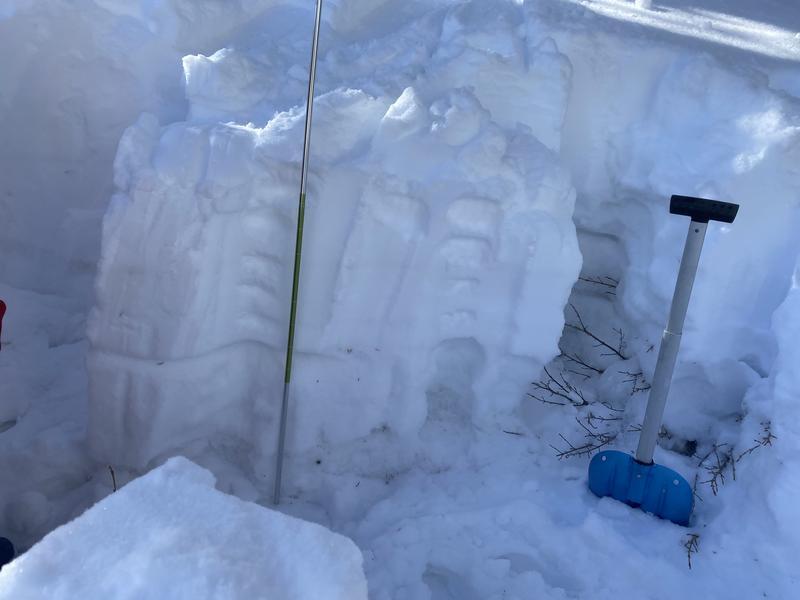
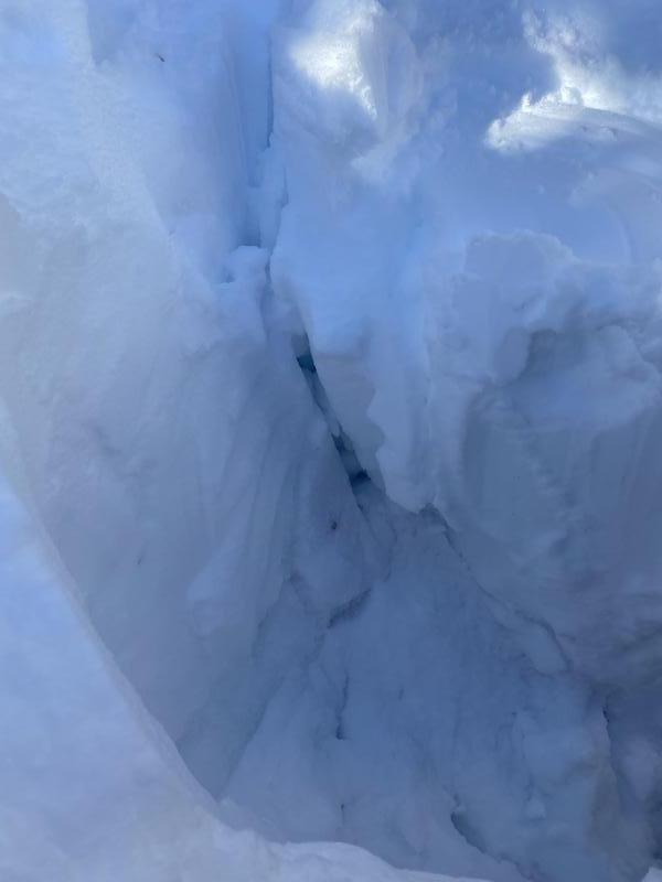
Snow pit revealed 105cm of snow at 9200 feet. The top 4 inches fell in the last 24 hours and was fist soft shifting to 4 fingers. 60cm there is a thin layer crust allowing for the section being pounded to drop at elbow 4 (ECT12). Around 30 cm above ground facets had formed and extended to ground, there was a 1 cm pencil hard ice layer located about 10cm off ground. The slab failed at 10 cm and the entire column shifted forward an inch (ECT16).
ECT4
Today's Observed Danger Rating
Considerable
Tomorrows Estimated Danger Rating
Considerable
Coordinates