
Observation Date
2/4/2021
Observer Name
Greg Gagne
Region
Salt Lake » Big Cottonwood Canyon » Days Fork
Location Name or Route
Days Fork
Comments
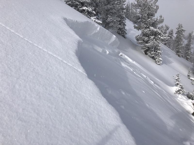
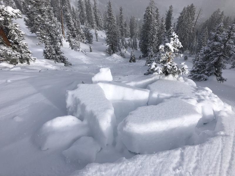
Lots of quick pits today plus wanted to look at the remotely-triggered slide from Tuesday on Chicken S&!t Ridge (CSR). The CSR slide was 2-3' deep, failing on faceted snow that formed earlier in January. I was able to safely access the flank of it, and was unable to isolate a column (CTC and ECTPV) as it would fail on this same persistent weak layer.
Other pits on East as well as Southeast aspects were ECTN, failing down 45-60 60 cms just below the Jan 23 weak layer.
We did not get any collapsing or cracking today, and I feel the snowpack is now giving us fewer indications of its instability. But the structure of a stronger slab on top of buried PWL remains a concern, and travel advice is still to avoid steep mid and upper elevation aspects facing west through east. Fortunately, lower-angled slopes are riding quite well!
Photos and video of Tuesday's CSR remotely-triggered slide. (ASr-R2-D2-O)
Video
Honestly unsure if additional wind and snow (with water possibly exceeding 0.5") will be enough to make the PWL active. Any new snow and wind-drifted snow will be reactive on top of the current surface of low-density stellar, and I wouldn't be surprised to see sluffing and soft slabs on Friday, especially during any period of higher precipitation intensity (PI).
Today's Observed Danger Rating
Considerable
Tomorrows Estimated Danger Rating
Considerable


