Observation Date
1/25/2021
Observer Name
John Lemnotis
Region
Salt Lake » Big Cottonwood Canyon » Cardiff Fork » Georges Bowl
Location Name or Route
Mill D - Georges
Weather
Sky
Broken
Wind Direction
East
Wind Speed
Calm
Weather Comments
Cool temps throughout the day and the clouds kept the sun at bay keeping the snow cold and dry. Winds never gusted stronger than light at best throughout our tour from 8a-3p.
Snow Characteristics
New Snow Density
Low
Snow Surface Conditions
Powder
Snow Characteristics Comments
The E aspects that we traveled on today were all low density powder where there weren't already tracks from the weekend crowds. The new snow hasn't seemed to settle at all! Areas that are untouched are prone to deep trail breaking and blower turns. However, the new snow was rather well behaved and is no longer sluffing or moving like it was yesterday or Saturday. We kept the angles low today, this hazard would certainly increase in steeper terrain.
Red Flags
Red Flags
Recent Avalanches
Heavy Snowfall
Poor Snowpack Structure
Red Flags Comments
Multiple avalanches were reported over the past two days that were associated with the new load of our storm. Many seemed to have slid on N/O interface and the two avalanches pictured below were no different (comments to follow with photos.) The snowpack structure remains poor and it is still a roll of the dice if you choose to ride in avy terrain where the PWL is present.
Avalanche Problem #1
Problem
Persistent Weak Layer
Trend
Same
Problem #1 Comments
PWL is still the main concern in our range. Structure trumps strength any day of the week and we still have a very poor structure. Patience is key in dealing with this problem that is now buried 60-90cm in our snowpack. We cannot ski cut a PWL and we can't rely on stability tests, continue to exercise caution on W-N-SE upper elevations and W-N-E at mid elevations. We are also dealing with the N/O layer that is comprised of near surface facets (NSF) on nw-n-e aspects. This new/old layer should gain strength in the coming days but caution is still warrented due to the underlying snowpack.
Avalanche Problem #2
Problem
New Snow
Trend
Decreasing Danger
Problem #2 Comments
Given the number of avalanches reported that were in the 18+/-" range we are certain that storm snow is a problem. These problems tend to heal relatively quickly, though a fear is for step down potential into the PWL deeper in the snowpack.
Comments
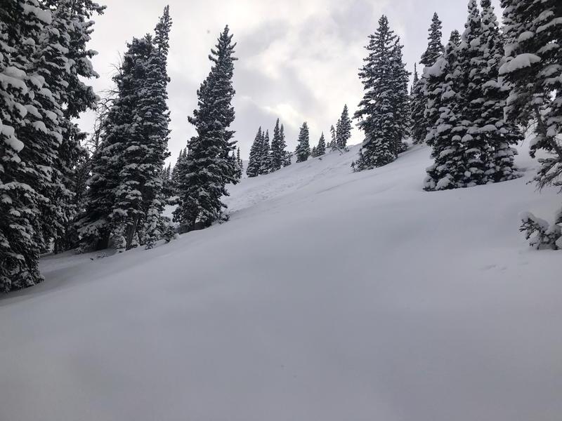
Photo 1 - SS-U-R2-D2 100x200x18"at 9800' E facing skiers right of the normal skin track for Georges bowl. Tracks surrounding this slide so I'm not sure if it was triggered or a natural during the storm but did not see this reported previously. Either way this small terrain feature has big consequences. Debris terminated in the trees and would've been a short but nasty ride.
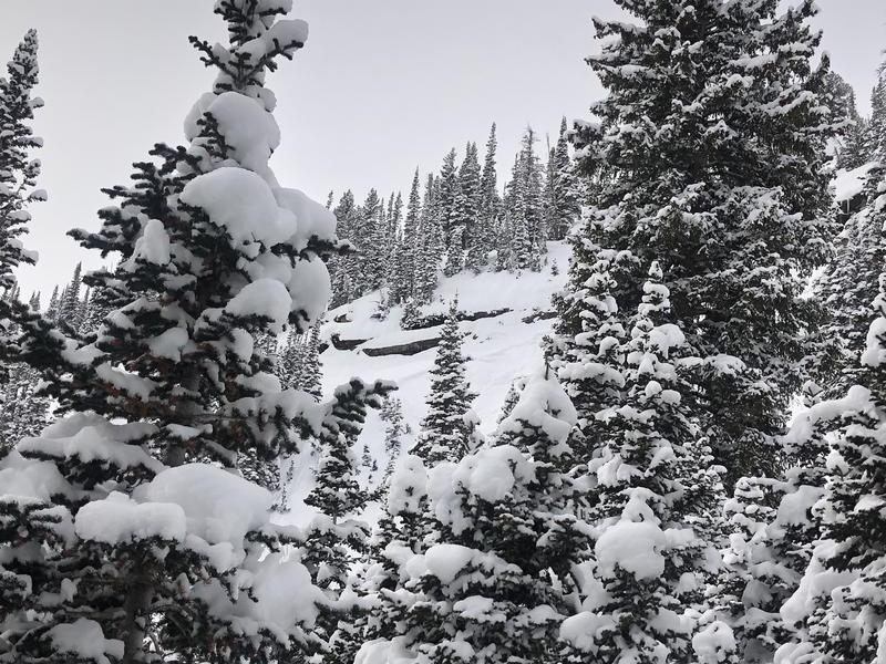
Photo 2 - SS-N-R2-D2 100x100x18" at 9700' E facing opposite the ridgeline from bengal tiger. This slide initiated below cliffs likely at the height of the storm.
Today's Observed Danger Rating
Considerable
Tomorrows Estimated Danger Rating
Considerable
Coordinates