
Observation Date
1/6/2021
Observer Name
Bill Nalli
Region
Uintas » Upper Weber Canyon
Location Name or Route
Upper Weber Canyon
Comments
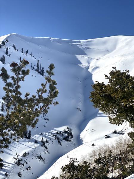
Per normal form, the current Uinta's snowpack makes the Wasatch look solid. On a short recon mission with the Park City Powder Cats we found north through east aspects above 9000' consist of mostly 4F to F hard facets from the ground to the surface. HS ranges from 40-80cm. Not much of a slab exists currently outside of the obviously wind-loaded zones below ridges and cross-loaded terrain features. A good storm with an inch of H2O will cause the hazard to rise significantly. Slopes facing south and west and those below 8500' are very thin with mostly just the latest storm as the snowcover. Localized cracking and collapsing was found on most slopes with over 40cm depth. Areas with wind drifts above this exceptionally weak snow are off limits for quite some time. Pic of east and northeast facing terrain at 10,500' with top and cross-loading.
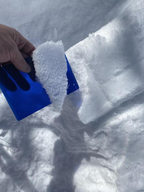
The sun came out today and warmed the snow surface on all sunny aspects leaving a crust of various thickness for tomorrow. It also created a new specimen of my favorite weak layer, Radiation Recrystallization. On southeast aspects above 9000' the strong warming from the sun was not enough to overpower the strong radiational cooling at the surface and we are left with this perfect balance of incoming and outgoing radiation. The result is warming below the snow surface that initially melts then freezes into a crust. The strong temperature gradient that exists both above and below this sub-surface melt-freeze crust creates weak snow sandwiching strong snow. Not a good recipe as we move into the future, unless you really want to make avalanches. Time will tell if this becomes a problem as this layer gets buried and we watch it evolve. You can see the thin crust in the photo below with dry weak snow above and below.
Today's Observed Danger Rating
Considerable
Tomorrows Estimated Danger Rating
Considerable
Coordinates


