Observation: Cardiff Fork

Observation Date
12/30/2020
Observer Name
CBrown
Region
Salt Lake » Big Cottonwood Canyon » Cardiff Fork
Location Name or Route
Mill D South/Cardiff
Weather
Sky
Clear
Wind Direction
Northwest
Wind Speed
Light
Weather Comments
CLR morning gave way to increasing clouds with OVC skies upon exit. Winds increased slightly after about 11:00. Temps stayed cool. Wild looking lenticular and/or Kelvin-Helmholtz clouds in the afternoon when exiting.
Snow Characteristics
Snow Surface Conditions
Powder
Wind Crust
Melt-Freeze Crust
Snow Characteristics Comments
Snow surfaces have taken a beating. The East winds Monday with the westerlies overnight have done a number on the snow quality. Saw some firnspiegel, sastrugi, wind board and powder all within 50'.
Red Flags
Red Flags
Wind Loading
Cracking
Collapsing
Poor Snowpack Structure
Red Flags Comments
Not as much collapsing today, but maybe that's because I and others have collapsed all the weak layers in the areas traveled. Structure remains poor but the slab seems to have gained more strength since Sunday, protecting the weak layer and making it more difficult to initiate failures. Dug in a similar spot to where I was on Sunday, below high Ivory, 9,700' ENE, HS 90cm, CTM13 SP down 18cm on the FC/PPrm buried on 20201222, ECTN14 on same layer, CTM15 SC down 45cm on the 20201211 FCsf that has been seeing a majority of the activity, ECTP30 on that layer. The FC seem slightly larger and weaker (maybe due to spatial variability), and the slab is stiffer, F-P. Noted cracking windslab in most aspects above 9,000'.
Avalanche Problem #1
Problem
Persistent Weak Layer
Trend
Same
Problem #1 Comments
Still thinking widespread/stubborn and up to size 3 are possible in the core. All of the areas I've observed outside the core seem to have much weaker & more developed FC and even DH and are probably widespread/reactive maybe size 2 due to slab having less continuity?
Avalanche Problem #2
Problem
Wind Drifted Snow
Trend
Decreasing Danger
Problem #2 Comments
More prevalent than I anticipated today, HS and SS.
Comments
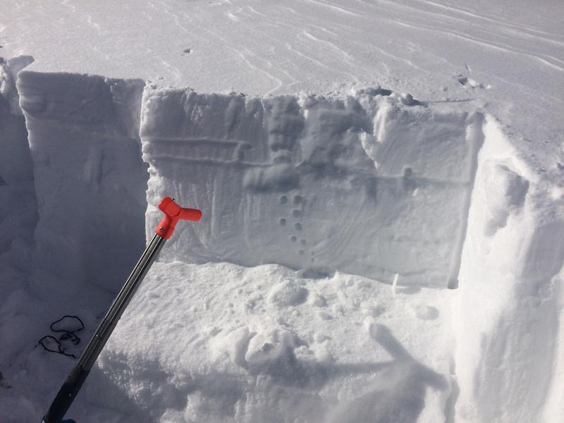
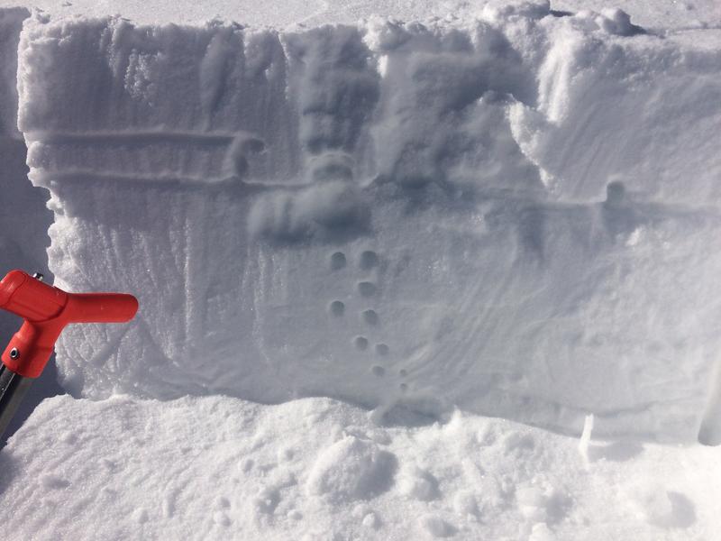
Pictures 1,2- ECT with F to P slab on top of FCsf, rime crust/FC noted with second horizontal line from top.
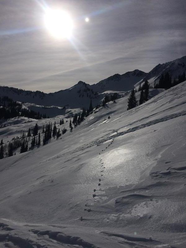
Picture 3-Wide variety of snow surfaces out there with the firnspiegel glaring in the sun.
Today's Observed Danger Rating
Considerable
Tomorrows Estimated Danger Rating
None
Coordinates