Join us for the 17th Annual Professional Snow and Avalanche Workshop (PROSAW) on November 4 - Purchase tickets here!

Observation: Bear River Range

Observation Date
12/23/2020
Observer Name
Jeremy
Region
Logan » Bear River Range
Location Name or Route
Bear river range
Weather
Sky
Clear
Wind Direction
North
Wind Speed
Moderate
Weather Comments
Cold AF. Sub zero wind chill out of the north and even some easterly winds on ridges at 8700 ft. Mostly stiff north/nw winds even in the lower elevations around 7k.
Snow Characteristics
Snow Surface Conditions
Powder
Wind Crust
Melt-Freeze Crust
Rain-Rime Crust
Snow Characteristics Comments
All types of fun snow conditions depending on aspect and elevation. I stayed mostly above 8000 ft and high point of 9400ft. Some scoured places to the wind hammered crust and drifts up to 4 ft deep in spots. I surfed south and west faces and conditions were excellent. Lower sections at 7500 ft were obviously thin and 3" on crust. Above that 7-10 inches new. Hard to tell what had fallen from the sky and what had blown in. New snow was very light and dry. Wind moves tons of it.
Red Flags
Red Flags
Recent Avalanches
Wind Loading
Cracking
Comments
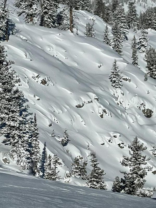
No audible collapses as have been common the past few days but I was on south and west aspects today. I observed a large avalanche on the north facing slope around 9300 feet in Cottonwood Canyon that looked to have happen naturally one or two days ago.
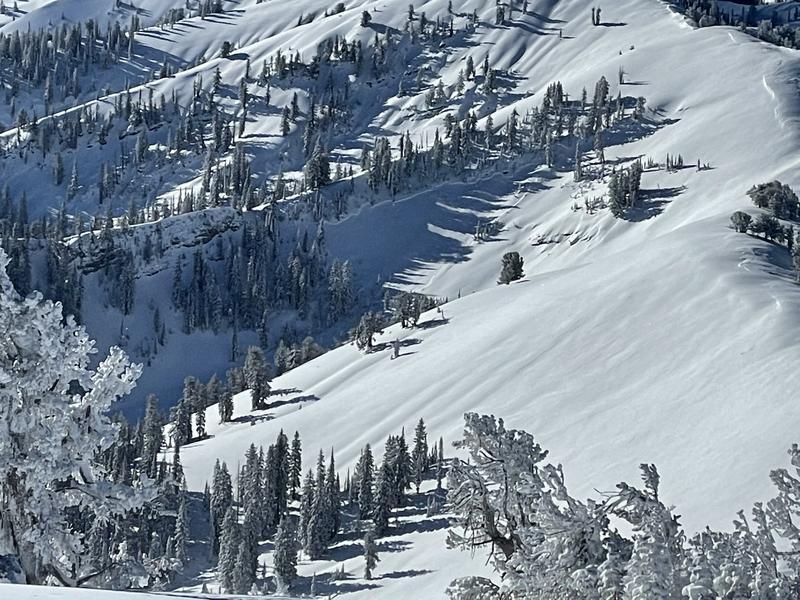
Widespread wind damage on upper ridges and bowls. Wind was swirling all day moving snow primarily southward but often in small tornados.
Today's Observed Danger Rating
Considerable
Tomorrows Estimated Danger Rating
Considerable