Observation: Cottonwood Ridgeline

Observation Date
12/18/2020
Observer Name
Hardesty and Meisenheimer
Region
Salt Lake » Little Cottonwood Canyon » Cottonwood Ridgeline
Location Name or Route
Flagstaff-Davenport-Michigan City
Weather
Sky
Obscured
Precipitation
Light Snowfall
Wind Direction
Northwest
Wind Speed
Calm
Weather Comments
Some sunbreaks early on. Southerlies took on a fair bit of heat mid-morning; may have a crust Sat morning.
Snow Characteristics
New Snow Depth
12"
New Snow Density
Low
Snow Surface Conditions
Powder
Red Flags
Red Flags
Recent Avalanches
Heavy Snowfall
Wind Loading
Cracking
Collapsing
Poor Snowpack Structure
Red Flags Comments
Fairly widespread avalanche cycle overnight in steep shady terrain in mid and upper elevations.
Avalanche Problem #1
Problem
Persistent Weak Layer
Trend
Same
Problem #1 Comments
We noted many naturals overnight Thursday into early Friday, finding just a couple inches on the bedsurface. Many ran mid-slope, Collapsing and cracking noted more often than not.
Few slides were more than 75' wide. Slab still consolidating. All noted ran at top of old facet interface 12-16" deep.
We remotely triggered three size 1.5-2 avalanches walking the ridgeline from Flagstaff to East Pass.
Snow Profile
Aspect
Northeast
Elevation
10,000'
Comments
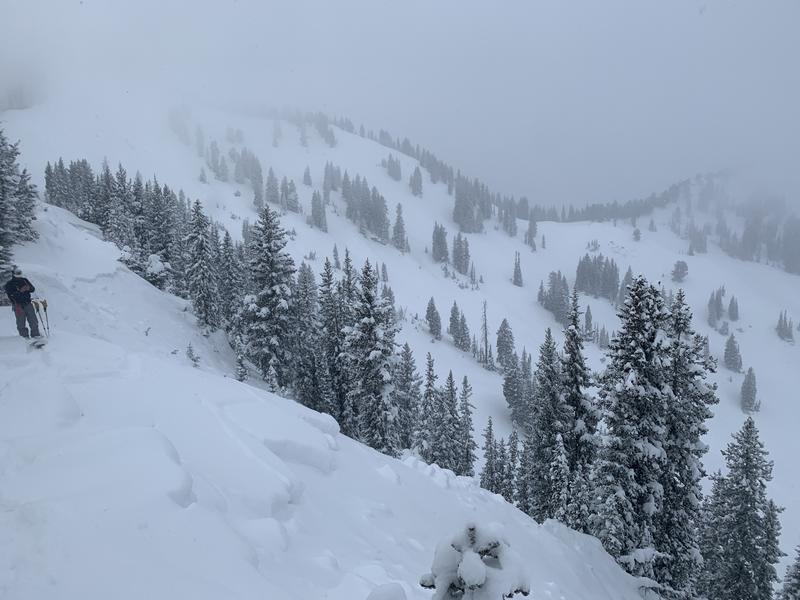
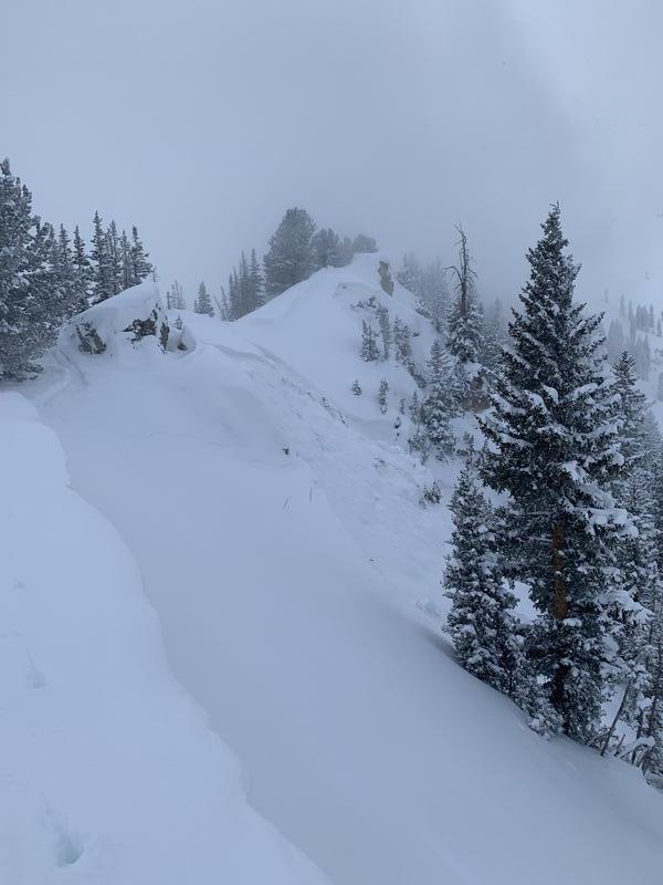
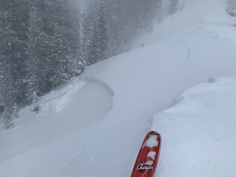
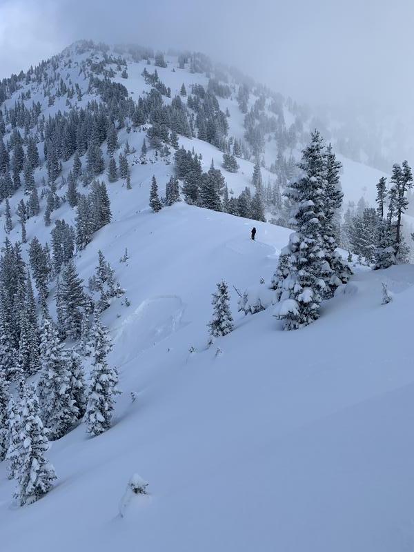
Profile dug where we experienced a collapse and remotely triggered an avalanche. Snow depth there was 65-75cm.
ECTN20 at failure plane of avalanche.
Dangerous avalanche conditions exist on many steep slopes at the mid and upper elevations. Remotely triggered avalanches will remain likely.
Today's Observed Danger Rating
High
Tomorrows Estimated Danger Rating
None