Travel was up Mill D south fork to Powerline. As has been well documented at this point, weak faceted snow was found above and below a melt freeze crust on East and West aspects, and faceted throughout on North aspects.
It was an interesting day to be out and with the next storm approaching, it may have been one of the last days to ski anything steeper than 30 degrees outside of South facing slopes for a while. With just enough of a lack of cohesion in the new storm snow, it feels like all it would take is the slightest bit of change and everything is going to start slabbing up and peeling off. e.g. warming, wind, settling overnight, or new snow added on top!
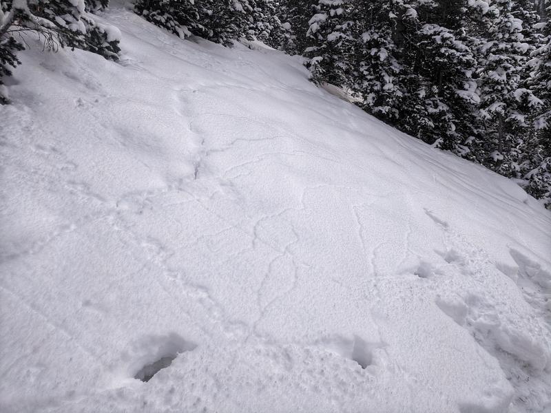
We did get one audible collapse on a West facing slope, and consistent failures within the new storm snow, without enough propagation to be a problem yet... Yesterdays high winds at upper elevations kept us off of that terrain, and todays sun and potential warming was enough of a reason to avoid steeper east facing aspects.
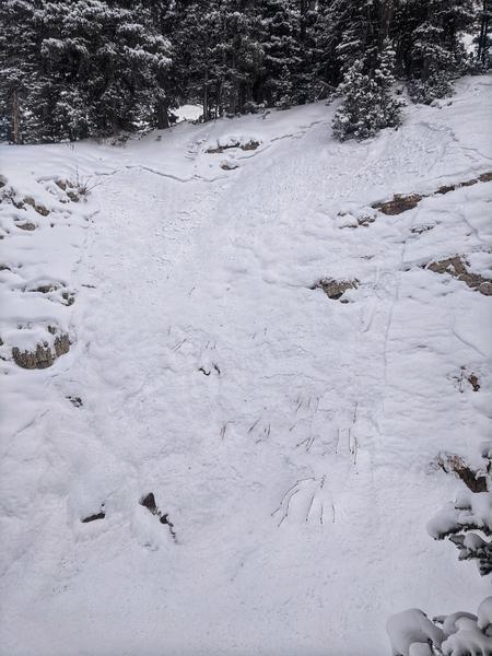
With everything hanging in the balance, one small but connected avalanche in the gully adjacent to the Powerline ridge is worth noting. The snow characteristics in this small pocket could not have been a whole lot different than everywhere else, but it was enough to form a connected storm slab.