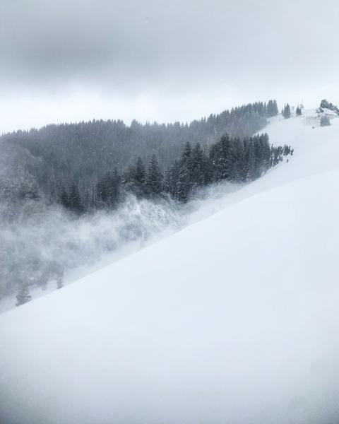
Hard to tell new snow amounts because of wind transport, but it seemed like 8-10 above 8500ft, of medium density.The snow was a little upside down in wind protected zones but not to bad, at the upper elevations in the wind it was either firm supportable wind drifts or slabby, and upside down with light density from earlier in the week underlying it. The wind was transporting the snow quite always down the N facing slopes like S Monitor and Scott's making hazard assessment even more difficult, the top of the slope seems solid and supportable which could lull you into a false sense of stability then get a ways down the slope, hit a thinner spot in the wind slab and trigger a avalanche that breaks well above and leaves you little hope of escape. Seems a bit early in the season to push the envelope seeing that the ground hazards involved with taking a ride could be traumatic. Wind slabs usually settle out with time, so in my opinion patience is a virtue at this point in time. The wind was still cranking when I left at 2:00pm
photos: wind transport and the cloud deck, also a video of wind transport at 2:00pm