Observation: Flagstaff Ridge

Observation Date
4/29/2020
Observer Name
R. Kosinski
Region
Salt Lake » Little Cottonwood Canyon » Flagstaff Ridge
Location Name or Route
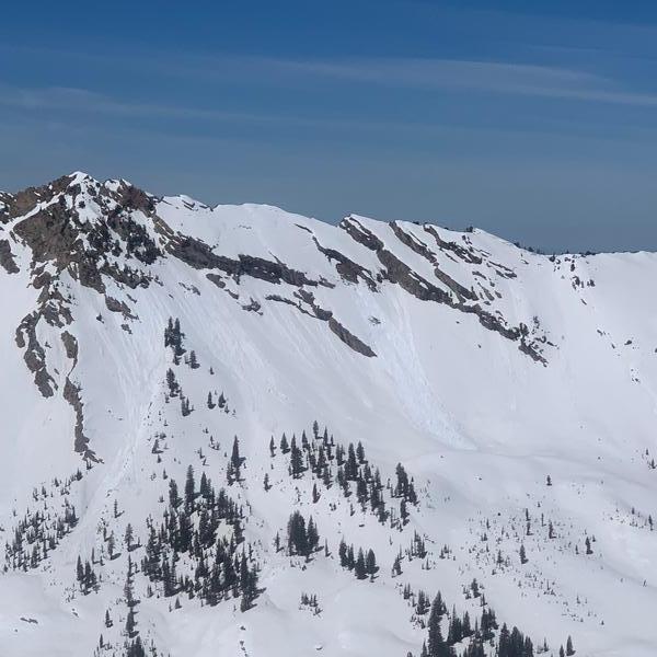
Flagstaff
Red Flags
Red Flags
Recent Avalanches
Collapsing
Rapid Warming
Avalanche Problem #1
Problem
Wet Snow
Trend
Same
Problem #1 Comments
Got on the trail around 10 and it was already very warm. The snow was slushy, warm, and wet. Ascending through 10,000' you could feel that the snow under the top few inches was pretty stout and the snow in shaded areas was still frozen. From the ridgeline you can see small D .5-1 slides coming off of cliffs and rocks but nothing big. It seems like we are at the tipping point of moving into a summer snowpack as most snow seems to be consolidated but there are a few areas where it hasn't fully done so yet. Water is percolating down through the snowpack and with a possible few days of refreeze next week, it looks like we are close to being in summer snow conditions.
Avalanche Problem #2
Problem
Normal Caution
Trend
Same
Problem #2 Comments
Cornices are breaking off in small to medium pieces. Glide cracks are showing on Ivory Flakes and there was one glide avalanche that has released. I was surprised to see how well the snow was holding up and it appears that avalanche activity is localized to extreme terrain and exposed rock.
Comments
Got to the top of Flagstaff at noon and there was no wind and temps were high. Beautiful day with unlimited visibility. Avalanche activity over the past few days appears to be minimal and localized. With very high temps and then colder overnight temps next week I would suspect that the snowpack will become more consolidated and we will see wet slide activity decrease.
Today's Observed Danger Rating
Low
Tomorrows Estimated Danger Rating
Low
Coordinates