Observation Date
3/28/2020
Observer Name
mark white
Region
Salt Lake » Mill Creek Canyon » Yellow Jacket
Location Name or Route
Yellow Jacket, Millcreek
Comments
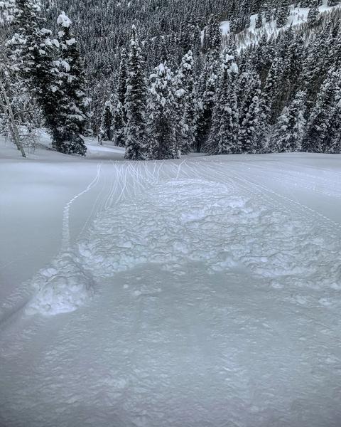
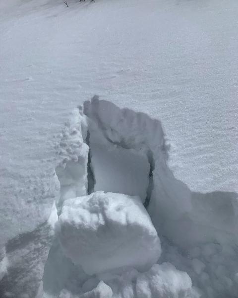
I was actually on the ridge between Yellow Jacket and Bowman Springs and made it to a elevation of about 9000ft, been trying to avoid people in more standard areas. The new snow from last night is a bit denser than the underlying snow creating a density inversion about 5 to 6 inches down, this density inversion is intensified in wind exposed terrain and in my multiple hand pits I was getting easy shears under the new winded snow failing on the lighter density snow underneath. There was also continued sluffing of the new snow on the steep N facing wind protected slopes. If the wind speeds pick up I would be suspect of E-NE facing slopes that are wind loaded. Not enough sun or heat for any wet activity in the terrain covered today.
photos: sluffing and one of my many hand pits.
Today's Observed Danger Rating
Moderate
Tomorrows Estimated Danger Rating
Moderate


