Observation Date
3/21/2020
Observer Name
Zimmerman-Wall/Hargrave
Region
Salt Lake » Little Cottonwood Canyon » White Pine » Lake Peak
Location Name or Route
Red Pine to White Pine
Comments
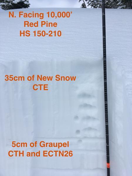
Traveled up Red Pine to Lake Shot and then up to Lake Peak and into White Pine. Skies were partly cloudy trending to mostly cloudy from 6am to 1pm. Temps remained below freezing and winds were generally light out of the South-Southwest. Brief period of flurries around 1130. Height of new snow from 3/19-3/20 storm was 30-40cm. Right side up but with several different crystal types that showed various levels of bonding, including a layer of graupel atoop the old snow surface. Ski quality in northerly facing terrain above 9500' feet remains good to very good. All other aspects and elevations below 9500' sported some sort of temperature crust. Parking lots were crowded and many groups noted in the field today.
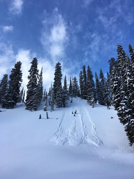
Photo 1: Loose Dry sluffs in the trees.
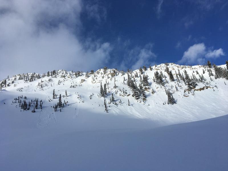
Photo 2: Loose Dry sluffs around cliffs
Photo 3: Storm snow structure
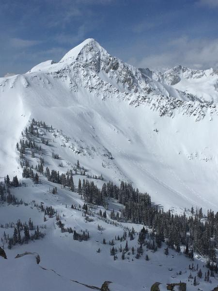
Photo 4: Upper Lake Shot/No Name Baldy
Today's Observed Danger Rating
Low
Tomorrows Estimated Danger Rating
None
Coordinates


