Sign Up for the Utah Snow and Avalanche Workshop (USAW) on December 7th!

Observation: Porter Fork

Observation Date
3/18/2020
Observer Name
Grainger
Region
Salt Lake » Mill Creek Canyon » Porter Fork
Location Name or Route
Porter Fork
Weather
Sky
Overcast
Wind Direction
South
Wind Speed
Light
Snow Characteristics
New Snow Depth
4"
New Snow Density
High
Snow Surface Conditions
Dense Loose
Damp
Snow Characteristics Comments
New snow depth on ascent ranged from a dusting at 6000' to 5" above 9000' N-facing. In the upper Porter basins this sits on a well-structured 1F-to-4F slab with deteriorated M/F crusts mixed in but posing little interface trouble.
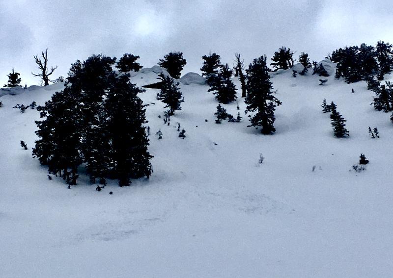
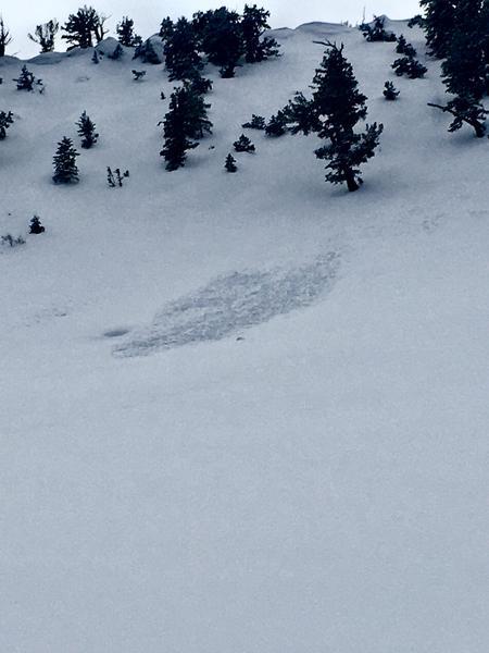
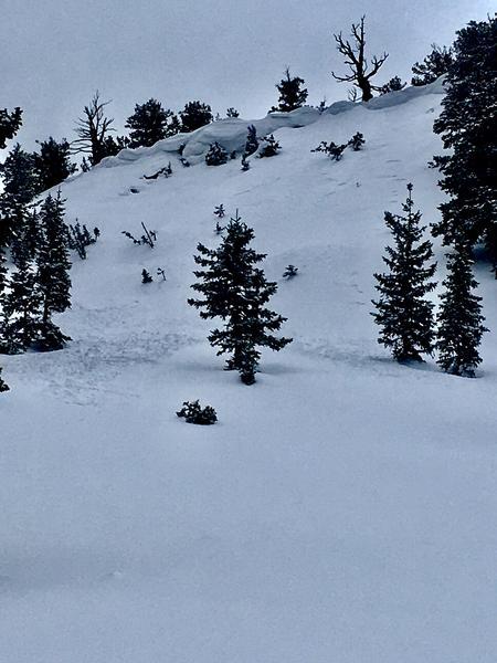
Only a few examples of natural dry-loose or southerly wind load activity. Near-ridgeline (lee) the new snow had minor slab characteristics but observed (small) slides were narrow and isolated to steep terrain directly under south-loaded cornices. These slides were small and soft, likely part of the natural cycle that higher terrain saw mid-day.
While skiing it was easy to feel last week's underlying M/F layer on slopes that saw direct sun or were low enough elevation (including NE-facing 8800' and below).
The day's cloud layer greenhoused the surface throughout the afternoon, initiating minor wet-loose activity at the lower elevations.
Freezing temps over most of this terrain tonight will help to adhere this layer to the crust and slowly improve the snow quality as more snow showers fall on top.
Red Flags
Red Flags
Wind Loading
Comments
Small slides NE-facing from under corniced ridgeline ~9300'. Soft slab characteristics are visible in #1 but overall each piece entrained very little.
Today's Observed Danger Rating
Low
Tomorrows Estimated Danger Rating
Low
Coordinates