Observation: Ogden

Observation Date
2/15/2020
Observer Name
Megan and Bill
Region
Ogden
Location Name or Route
Bullnose
Weather
Sky
Overcast
Wind Speed
Calm
Weather Comments
At lower elevations, winds were almost nonexistent. Temperatures were in the mid-30s and for the brief time the sun, there was solar effect.
Snow Characteristics
Snow Surface Conditions
Rain-Rime Crust
Snow Characteristics Comments
Rain crust found on all aspects at lower elevations but assumed to be present up to Ben Lomond peak as well. Breakable crust on most aspects with a supportable crust on southeast-south aspects.
Red Flags
Red Flags
Poor Snowpack Structure
Red Flags Comments
Below the rain crust is a weak layer of faceted snow. There was no snow on top of the crust. The crust was about an inch to an inch and a half thick and the faceted layer was less than half an inch thick. The crust was pencil hardness. When broken the crust would sheer cleanly (see the video included in this observation). This was not a problem today but has the potential to be an issue if/when a load is applied. These will be layers to keep an eye on for a while.
Avalanche Problem #1
Problem
Persistent Weak Layer
Trend
Increasing Danger
Problem #1 Comments
Though this wasn't an issue today, in the future the faceted snow under the rain crust could become a persistent weak layer. As we receive more snow and more load is applied to this weak layer we may start to see some slide activity. Faceting below the rain crust will most likely continue creating a deeper weak layer.
Comments
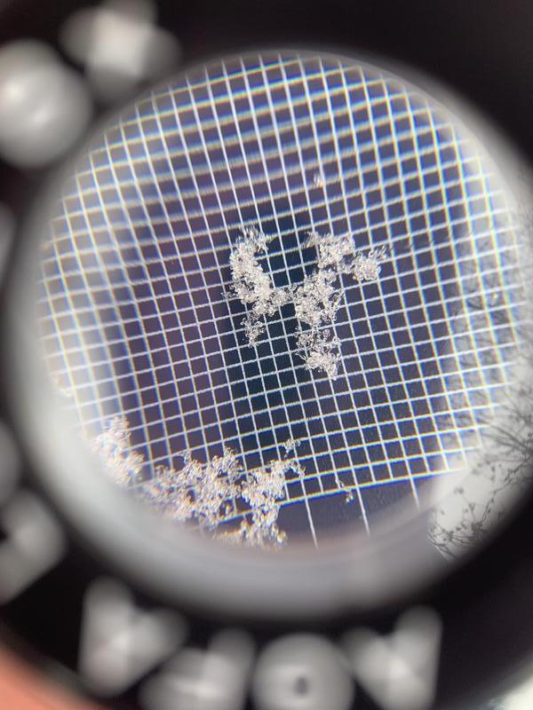
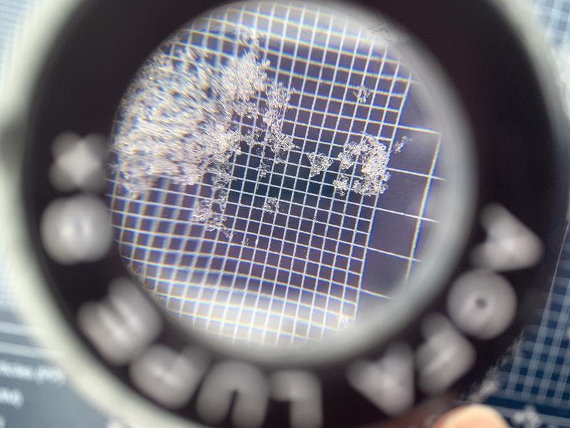
When parts of the crust broke free there was a Q1 sheer on the faceted layer just below the crust.
Faceted snow from just below the rain crust.
Today's Observed Danger Rating
Low
Tomorrows Estimated Danger Rating
Moderate
Coordinates