Observation Date
1/19/2020
Observer Name
Hardesty and Bombard
Region
Salt Lake » Big Cottonwood Canyon » Cardiff Fork » Superior
Location Name or Route
Superior
Comments
Mostly a non-event observation. Went looking for rogue wind slabs along the higher elevations of the Cottonwood ridgeline. Found none that were reactive. Many steep lines on northwest to east facing skiied in upper Cardiff Fork as well as steep southerly terrain above LCC.
Wet loose as advertised with today's sun/heating and easy to time and/or avoid. We chose the north facing helicopter chutes.
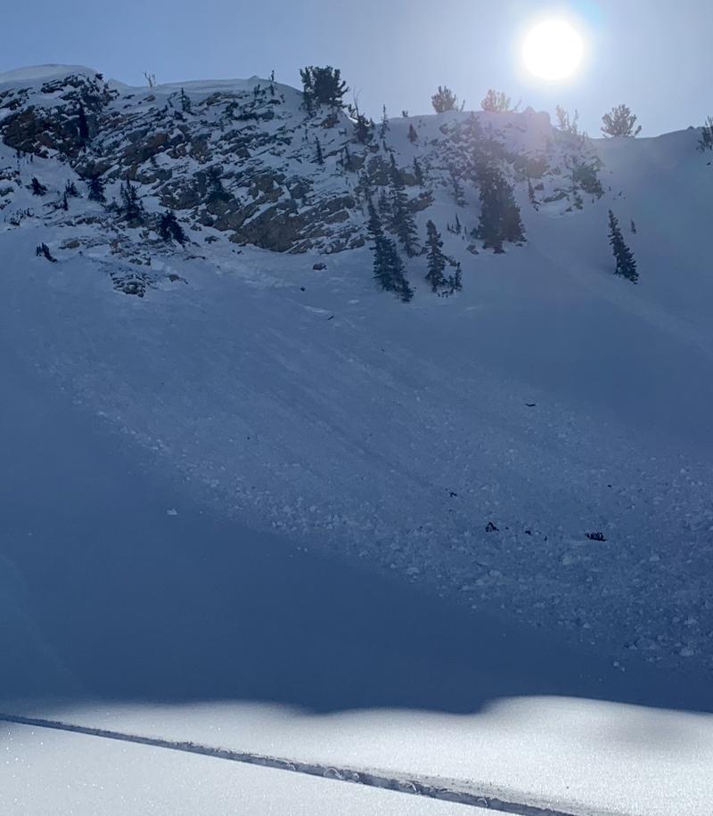
The Mill B South avalanche(s) from today are concerning. Likely radiation recrystallization facets from Wed/Thurs and buried Friday and sheltered from the wind. This to be looked into more closely.
The cornice-triggered avalanche along the Cottonwood ridgeline (west of the Keyhole) from Saturday then triggered a 12-24" deep 30' wide pocket into faceted snow in this very steep rocky terrain that is not representative of most of the north facing terrain. Caution is still warranted in this type of rocky shallow terrain.
Surface hoar even noted up high.

Today's Observed Danger Rating
None
Tomorrows Estimated Danger Rating
None


