Observation Date
12/27/2019
Observer Name
Meisenheimer
Region
Salt Lake » Big Cottonwood Canyon » Broads Fork
Location Name or Route
Broads Fork
Comments
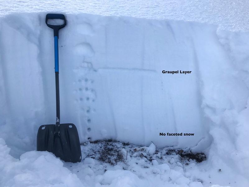
I decided to dig my first pit on a north facing slope at 8,200' in elevation. I was quite surprised to find a very stable snowpack at this elevation. This is exactly what we want to see - lighter snow on the surface followed by harder and harder snow as we move down to the ground. There was one layer of concern (graupel) down about 12-15" but this layer produced no results in stability tests.

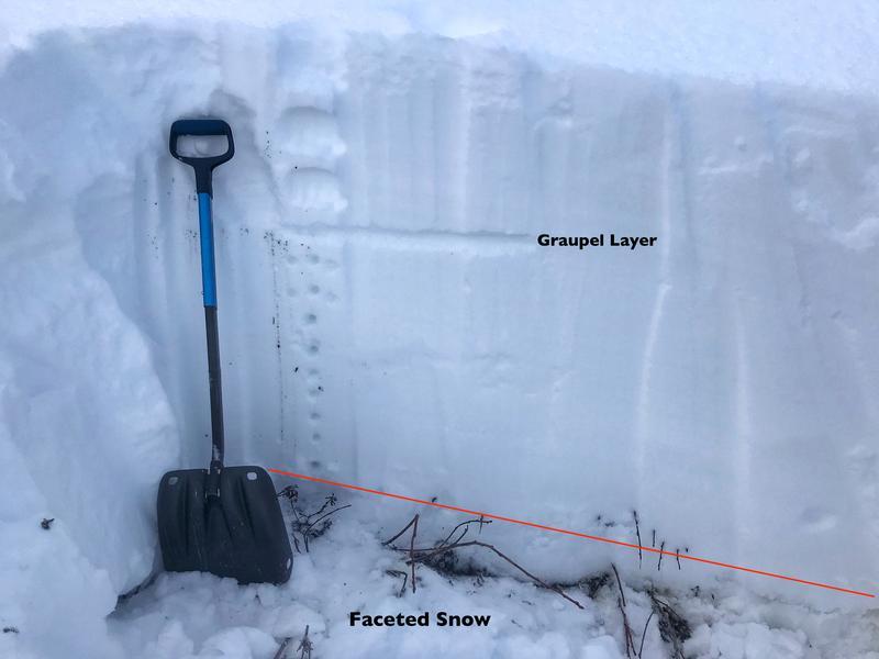
Just a little higher in elevation (8,500') on a northerly facing slope I was able to find weak faceted snow at the base of the snowpack. Here, the weak layer was only 2-5" thick and very wet and damp ( I will be the first to admit - I don't know what that means) but it's better than it being dry and fist hardness with faceted snow pouring out of the wall. I did an Extended Column Test and it revealed no propagation as well.
Tomorrow - I will be going back to the same area to get higher in elevation to see what is present above 9,000'.

Overall - I found a low avalanche danger on slopes facing north below about 8,800' in Broads Fork. After, digging in multiple locations and doing my homework we decided to ride steep aspects that faced the north half of the compass. Today was the first north facing slope over 36° in steepness that I've skied this season. I would follow the same conservative approach on slopes that are higher in elevation and more suspect for old weak snow. Even though I found stable snow, we still skied one at a time and had clear communication on a plan in case we were wrong.
Great Skiing!
Today's Observed Danger Rating
Low
Tomorrows Estimated Danger Rating
None


