UDOT PLANNED AVALANCHE CLOSURES!!

Observation: Uintas

Observation Date
12/16/2019
Observer Name
jg
Region
Uintas
Location Name or Route
Wolf Creek Pass
Weather
Sky
Broken
Wind Direction
West
Wind Speed
Light
Weather Comments
Light winds blowing snow out of the trees and moving a little bit pf snow. Cold, temps in the single digits and low teens. Data from the Currant Creek Wx station wasn't available.
Snow Characteristics
New Snow Density
Low
Snow Surface Conditions
Powder
Snow Characteristics Comments
Cold powder snow conditions. Very light density snow on the snow surface.
Red Flags
Red Flags
Recent Avalanches
Collapsing
Poor Snowpack Structure
Red Flags Comments
Observed signs of slides that went during the storm cycle. One collapse while ascending on skis.
Avalanche Problem #1
Problem
Persistent Weak Layer
Trend
Same
Snow Profile
Aspect
East
Elevation
9,600'
Slope Angle
28°
Comments
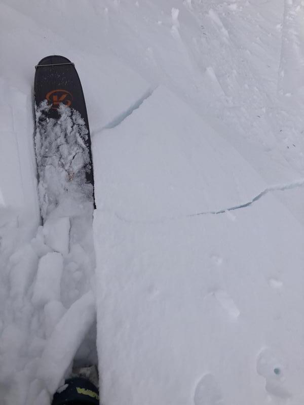
Went up to Wolf Creek Pass and had a quick two lap ski north of the pass on Camp Peak (9750). I was surprised how little overall snow I found where I dug my pit, 28". Pit results continue to reflect weak basal snow with columns failing with medium effort in this layer. Plenty of slope testing going on today with a decent amount of sled traffic on steep east facing slopes with no results. I noticed several pockets that released naturally during the storm cycle.
Stubborn wind slab on the ridge line
Today's Observed Danger Rating
Considerable
Tomorrows Estimated Danger Rating
Considerable