Observation Date
11/17/2019
Observer Name
Doug Wewer
Region
Ogden » Ogden Mountains
Location Name or Route
Mount Ogden
Weather
Sky
Clear
Wind Speed
Calm
Weather Comments
Here’s some observations of the existing snowpack in the Ogden Mountains. The storm forecast this week isn’t expected to be very large, but you never know...
I took a walk to check out the upper elevation snowpack near Mt. Ogden. I think the general snowpack right now is similar near Ben Lomond and James Peak, but possibly a bit thinner.
Snow exists only on primarily shady slopes. Anything with sun exposure, even at the highest elevations is bare or patchy at best. This includes nearly all East, South and West aspects far enough away from a steep ridge or head wall to get sun this time of year. The shadow line is literally the difference between winter and summer right now.
In general, above 8000’, the snow that remains is about 12 inches deep. Slightly deeper in wind loaded areas. The depth tapers off as you reach the shadow lines or drop in elevation.
Snow is generally F and 4F facets, with intermittent crusts from melt/freeze or wind. The hardest crusts were 1F but not supportable by boot. The weakest and most developed facets I found were in the upper half of the snowpack. If I have the dates right, the lower half of the snowpack is older (Oct. 20) and fell prior to the relatively warm temps in mid/late October (Oct. 20-26). When I was out on Oct 27, I noted that this lower snow hadn’t faceted much (yet) and had some time to consolidate. I also observed some M/F crusts on low-angled northerly aspects at mid-elevations. The new snow that fell on the 27th (light density) and 29th was immediately exposed to cold arctic temperatures through the end of the month, which appeared to cause rapid faceting.
The little bit of snow on or near the sunny aspects was damp or had a M/F crust.
Snow Characteristics
Snow Surface Conditions
Faceted Loose
Wind Crust
Melt-Freeze Crust
Damp
Comments
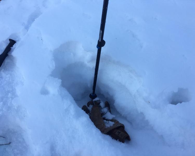
Snowpit #1 at 8700’ N/NE aspect. Approx 12 inches total depth.
Video
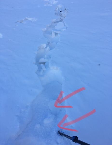
Snowpit #2 at 9000’, North aspect, in shallow, wind affected gully. Approx 15 inches deep. Pit from left side of first photo.
Arrows on 2nd photo indicate sugary facets pouring out of the snowpack under the wind crust.
Video
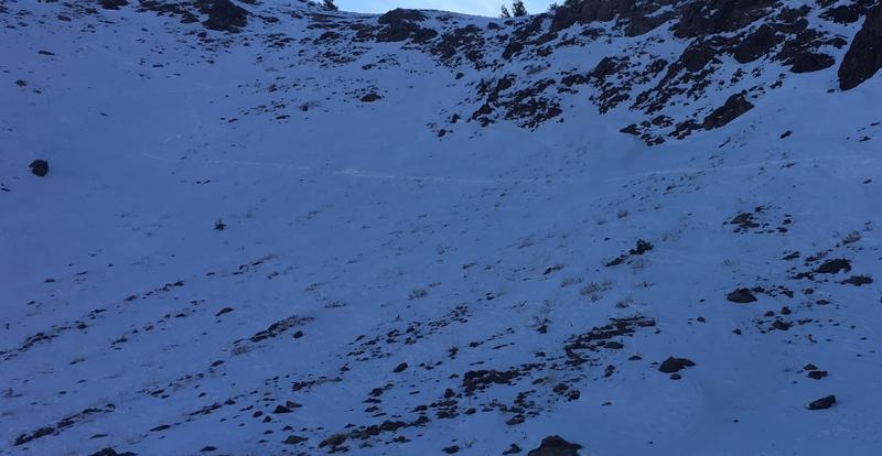
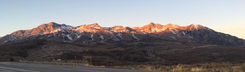
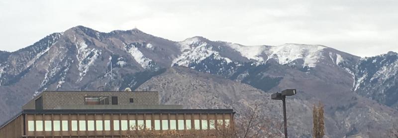
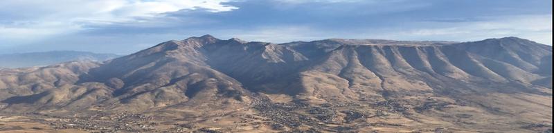
I included these photos to show the general aspects and elevations that are retaining snow. First two photos are of mountains near Mt. Ogden. First is from Northeast side. Second is from West (Ogden) side.
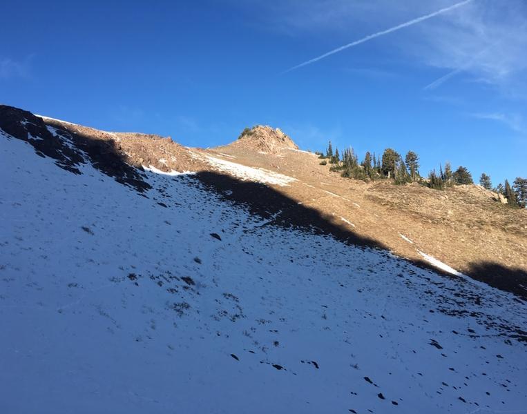
The third photo shows the distinct snow/dirt line that is parallel with the shadow line.
Last photo is of snow-free south facing terrain near James Peak.
Today's Observed Danger Rating
Low
Tomorrows Estimated Danger Rating
Low