Observation Date
3/29/2019
Observer Name
Kikkert
Region
Uintas » Upper Weber Canyon
Location Name or Route
Upper Weber Canyon
Weather
Sky
Overcast
Precipitation
Moderate Snowfall
Wind Direction
Northwest
Wind Speed
Moderate
Weather Comments
Cloudy with off and on snow showers all day. Snowfall rates everywhere from light to heavy at times. Winds were gusty but overall moderate where we were.
Snow Characteristics
New Snow Depth
12"
New Snow Density
Low
Snow Surface Conditions
Powder
Snow Characteristics Comments
9” new overnight with another 3” or so during the day giving totals around a foot. Density was 5-6%.
Red Flags
Red Flags Comments
No real red flags, little over half and inch of water with moderate winds. However, enough to pay attention, especially in the morning before things began to settle out.
Avalanche Problem #1
Problem
Wind Drifted Snow
Trend
Decreasing Danger
Problem #1 Comments
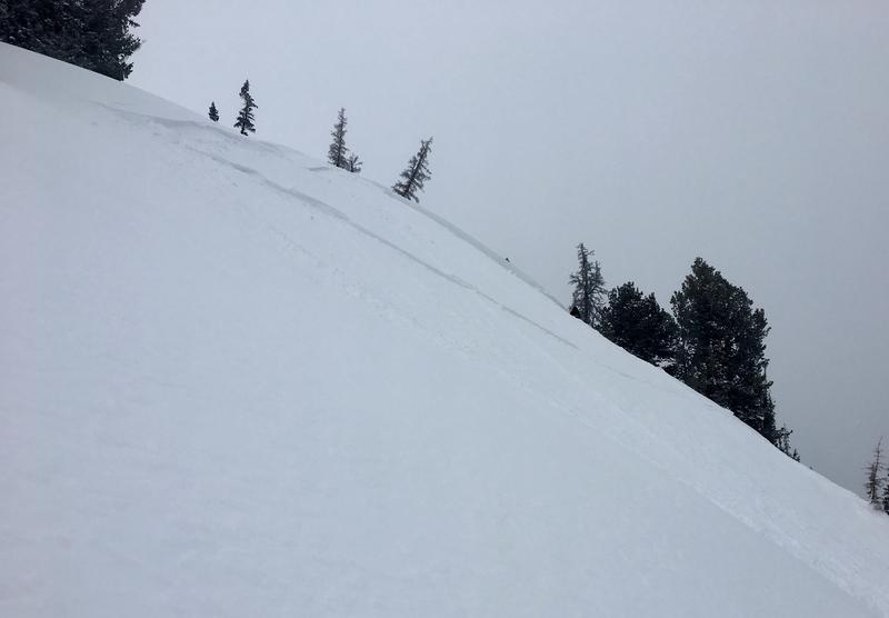
We were able to ski cut out a couple soft slabs. The deepest was about 2’ deep and 50’ wide (see photo below). They were pretty sensitive in the morning, easily breaking right at your skis and running on the melt freeze crust from before the storm. Typical of spring, by early afternoon they had already begun to settle out and bond to the underlying crust.
Avalanche Problem #2
Problem
New Snow
Trend
Decreasing Danger
Problem #2 Comments
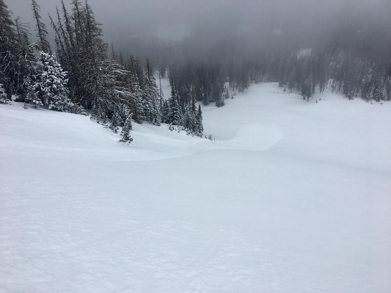
Out of the wind the snow would still break easily st your skis and run as loose snow avalanches. Like noted above for wind drifted snow, things began to settle out in the afternoon.
Photos show wind slab triggered on a ski cut. Slope was NE facing with a slope angle around 40 degrees. Slab was 2’ deep and 50’ wide, running approximately 300’.
Today's Observed Danger Rating
Moderate
Tomorrows Estimated Danger Rating
Moderate