Observation Date
3/28/2019
Observer Name
Hardesty, PCMR Snow Safety
Region
Salt Lake » Park City Ski Resort
Location Name or Route
Park City Mountain Resort (PCMR)
Comments
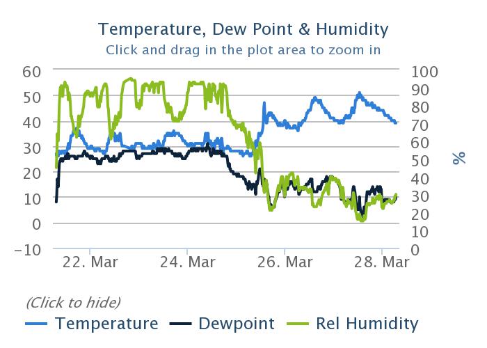
With 72 hours of above freezing temperatures along the mid-elevation "thermal belt", I went to check in with the PCMR team working along the southern end of the PC ridgeline. This area tends to be the bellwether for wet avalanching beyond the more superficial wet sluffs and damp storm push-alanches. See the 7 day graph for the PCMR Eagle weather station below. As you can see, the last decent refreeze was overnight 24th into the morning of the 25th.
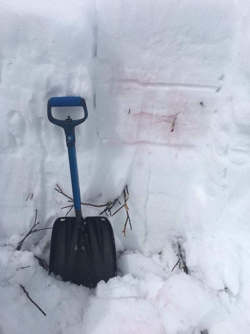
Common wet slab areas are these mid-elevations facing northeast to east to southeast when there is water pooling along interfaces and/or large facet and depth hoar boundaries. We profiled these locations and found that the snow was isothermal but had decent structure and had no significant pooling along layer boundaries (pic below). HS was roughly 60-80cm. The top 15-20cm of snow here exists as large coarse wet grains that had enough cohesion overnight/morning cooling/wind to be stable. IE - only very small initiated sluffs possible. This may have been more active with any more heating/sun after I left mid-afternoon. Overall we found mostly stable isothermal snow with little expectation of near-term avalanching.
The outlier exists at the base of the snowpack at these aspects/elevations where localized areas of 5mm facets>wet grains exist (4F+). These may be worth more attention with subsequent warm ups. Which, it appears, is not for awhile.
Crusts will be found on nearly all aspects and elevations (wind crust high north) with perhaps a trace to an inch of graupel from today. Will this graupel act as a decent weakness for tonight/tomorrow's storm? It'll be something to confirm or rule out if heading out tomorrow.
Today's Observed Danger Rating
Low
Tomorrows Estimated Danger Rating
None


