Observation Date
3/24/2019
Observer Name
Bill Brandt, Megan Brandt, Lee Fortin
Region
Ogden » Ben Lomond » Cutler Ridge
Location Name or Route
Upper Cutler
Weather
Sky
Obscured
Precipitation
Heavy Snowfall
Wind Direction
Northwest
Wind Speed
Moderate
Weather Comments
Moderate snowfall early in the day transitioning to heavy snowfall midmorning. Winds were light at lower elevations increasing to moderate above 7,500ft. Winds direction ranged from West to Northwest.
Snow Characteristics
New Snow Depth
4"
New Snow Density
High
Snow Surface Conditions
Powder
Damp
Snow Characteristics Comments
Snow was sticky and heavy at lower elevations. At upper elevaions there was higher density powder 4-6 inches deep.
Red Flags
Red Flags
Recent Avalanches
Wind Loading
Cracking
Red Flags Comments
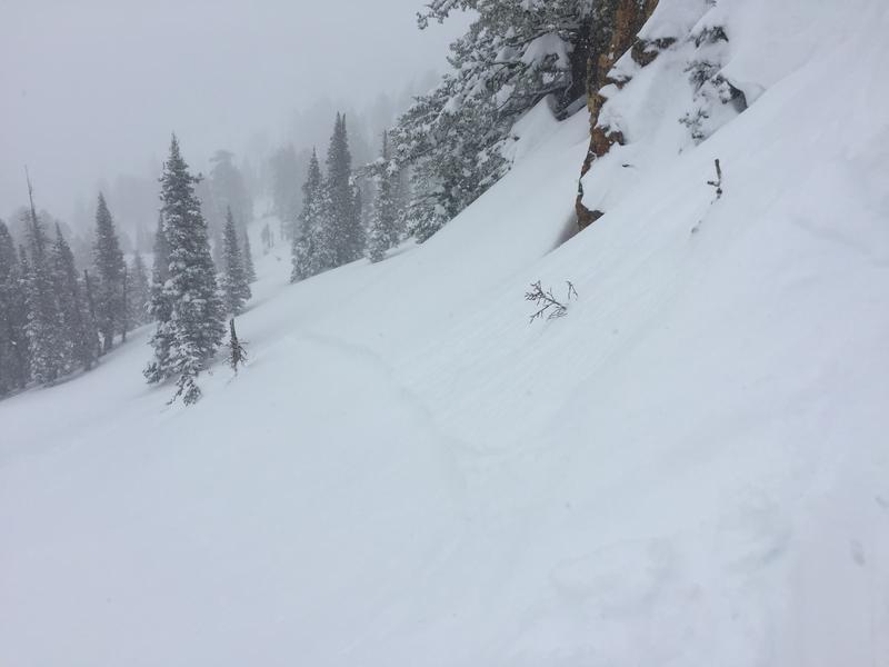
Intentionally trigger avalanches on 8,500ft, northeast slopes. Some but not all of the slopes were wind loaded. The avalanches tended to have 6 inch crowns , good propogation and a decent amount of energy. They could potentially knock you off your feet. They ran 30-250ft and were 30-80ft wide.
Avalanche Problem #1
Problem
New Snow
Trend
Decreasing Danger
Problem #1 Comments
Avalanches failed on the new/old snow interface.
Avalanche Problem #2
Problem
Wind Drifted Snow
Trend
Decreasing Danger
Problem #2 Comments
Winds from the West-Northwest were transporting significant amounts of snow to the East-Southeast slopes.
Comments
Slides had the potential to knock you off of your feet and had high energy. In areas where the slopes fanned out, the slides were manageable. If the terrain funnelled or was rocky/tree filled below the danger increases significantly.
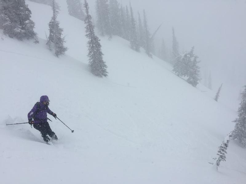
First photo shows crown of one intentionally triggered slide. In the second photo, if you look closely, you can see the slope fracturing below and behind the skier. Video of winds on Cutler Ridge.
Video
Today's Observed Danger Rating
Considerable
Tomorrows Estimated Danger Rating
Moderate