Observation Date
3/22/2019
Observer Name
Bill Brandt
Region
Ogden » Ben Lomond » Cutler Ridge
Location Name or Route
Cutler Ridge
Weather
Sky
Obscured
Precipitation
Moderate Snowfall
Wind Direction
South
Wind Speed
Moderate
Weather Comments
Moderate snowfall for most of the day. Rain below 6,800 ft. on exit. Gusty winds moving snow.
Snow Characteristics
New Snow Depth
12"
New Snow Density
High
Snow Surface Conditions
Dense Loose
Damp
Snow Characteristics Comments
Dense wind packed powder above weather station which was about 12 inches deep. Wet damp sticky snow below weather station about 4-6 inches.
Red Flags
Red Flags
Wind Loading
Cracking
Collapsing
Avalanche Problem #1
Problem
Wind Drifted Snow
Trend
Same
Problem #1 Comments
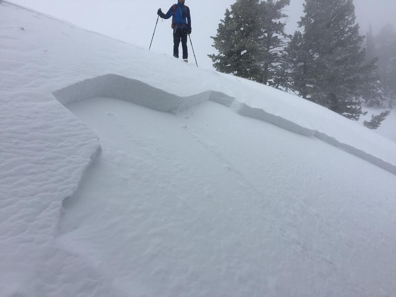
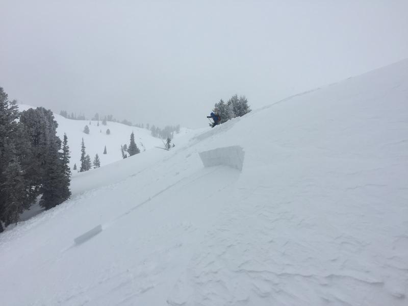
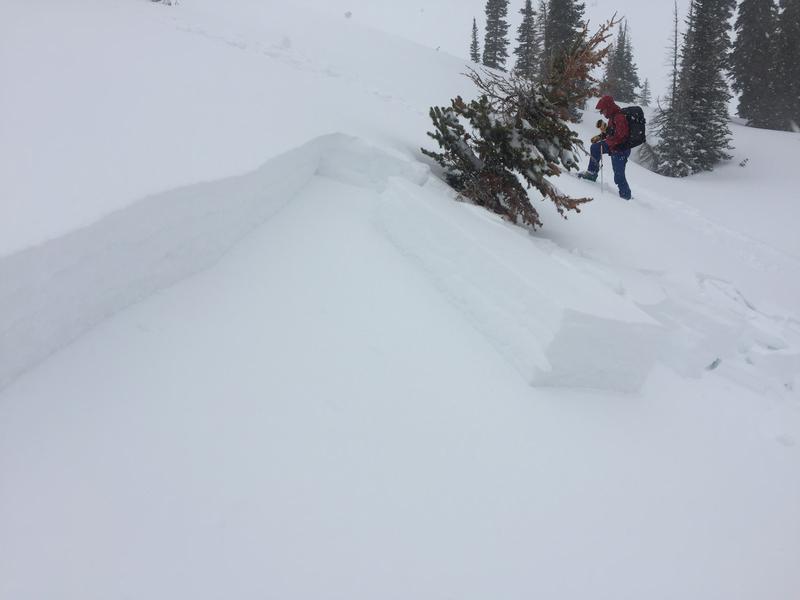
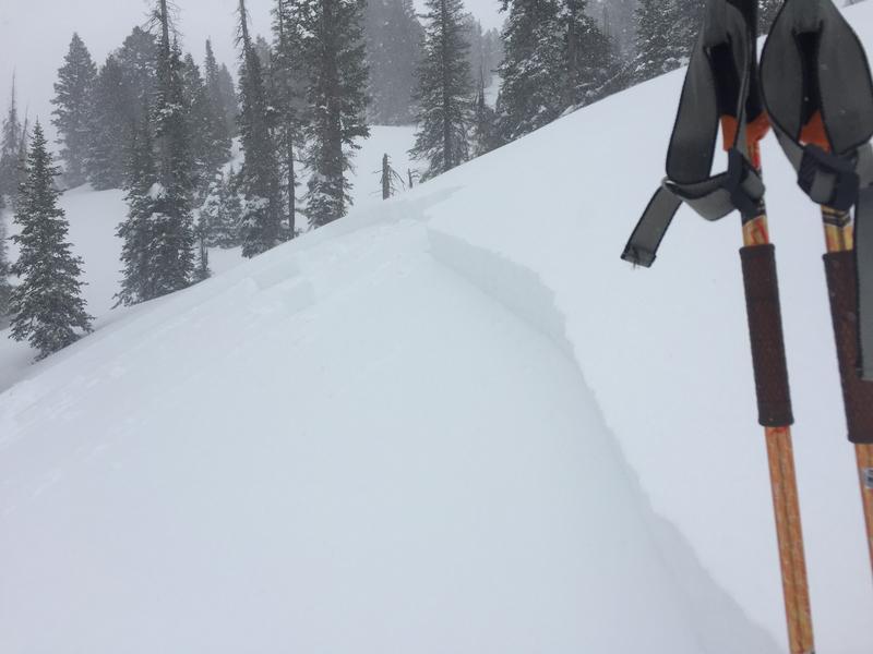
Upside down snow. Easily triggered and remotely triggered wind slabs. Test slopes ran 60-80 vertical ft and varied from 40-100 ft across. NNE 40 degree slope at 8100 ft. This ran on a density change between yesterday's snow and today's new snow which was about 4 inches above the old snow crust. We didn't venture into steeper more avalanche prone terrain as approach from below didn't seem wise. Unable view Ben Lomond or ridges to the south due to cloud cover.
Avalanche Problem #2
Problem
New Snow
Trend
Same
Problem #2 Comments
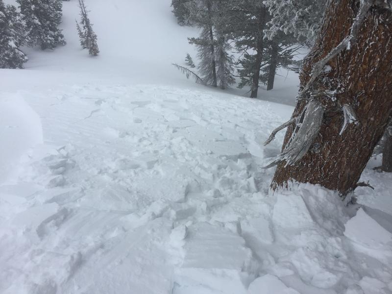
Remotely triggered a slide while skiing on a steeper section of a nearby slope. N 34-36 degree slope at about 7200 ft. This ran on buried surface hoar and NSF.
I hesitate to call these avalanches because they didn't run far. On a bigger slope I suspect it would be a different story. The first 3 photos are at 8100 ft and the last 2 are at 7200 ft.
Today's Observed Danger Rating
Considerable
Tomorrows Estimated Danger Rating
Considerable