Observation: Upper Weber Canyon

Observation Date
3/5/2019
Observer Name
Kikkert
Region
Uintas » Upper Weber Canyon
Location Name or Route
Upper Weber Canyon
Weather
Sky
Broken
Wind Direction
Southwest
Wind Speed
Moderate
Weather Comments
Sky started out with scattered clouds in the AM, clouding up around 2-3 pm. Winds were light in the AM, finally increasing in speed around 3 pm.
Snow Characteristics
Snow Surface Conditions
Powder
Dense Loose
Melt-Freeze Crust
Snow Characteristics Comments
Aspects with south in them were crusted in the AM due to warming the previous day. However, E through W still held soft snow into the afternoon.
Red Flags
Red Flags
Wind Loading
Poor Snowpack Structure
Red Flags Comments
Really not that many red flags out there today. Snow structure is bad in some places, but improving significantly in others. Winds were generally light most the day, with speeds increasing only later in the day after I had left. That said, there are still left over wind slabs that a person could trigger.
Avalanche Problem #1
Problem
Wind Drifted Snow
Trend
Increasing Danger
Problem #1 Comments
Still some old wind slabs out there that were sensitive to testing today. Largest was a bit over 100' wide and up to 12" deep. Ran approx. 500 vert. See photo below. Would expect new wind slabs in the morning due to the forecasted increase in winds and new snow. In many places these will fall on weak surface snow and could be touchy.
Avalanche Problem #2
Problem
Persistent Weak Layer
Trend
Increasing Danger
Problem #2 Comments
Did not have much time to investigate snowpack structure in suspect repeater areas. However, of note is that the wind slab mentioned above (and shown below in picture) was in a repeater area and despite entraining a fair amount of snow, did not step down into older snow. Encouraging. Was able to take a quick look at structure in another repeater path and found that old Dec. facets to be strengthening. The question is whether the storm on our doorstep will have enough weight to re-activate these deeper week layers. Gonna be patient and see what happens.
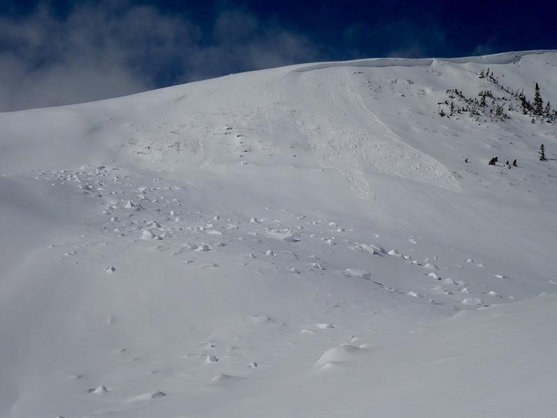
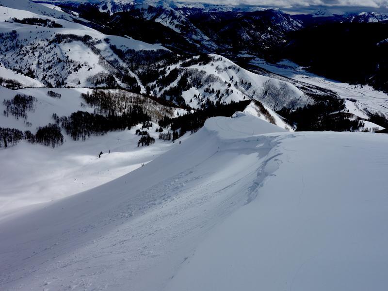
First photo shows some wet loose activity from Monday. Second photo shows wind slab avalanche from today.
Today's Observed Danger Rating
Moderate
Tomorrows Estimated Danger Rating
Considerable