Observation Date
2/28/2019
Observer Name
Ted Scroggin
Region
Uintas » Bear River Ranger District » Gold Hill
Location Name or Route
Gold Hill
Weather
Sky
Broken
Precipitation
Light Snowfall
Wind Direction
Southwest
Wind Speed
Moderate
Weather Comments
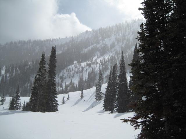
Mild start to the day with temps in the high 20's to low 30's and calm winds at the trial head. Gusty winds were blowing along the ridge lines and at times getting into the lower and mid-elevation terrain.
Snow Characteristics
New Snow Depth
2"
New Snow Density
Medium
Snow Surface Conditions
Dense Loose
Wind Crust
Snow Characteristics Comments
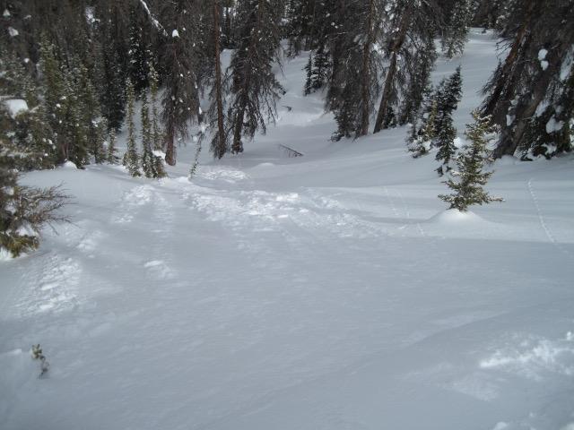
Around two inches new in Gold Hill which did help soften the hard frozen tracks, but the winds have worked over much of the terrain.
Red Flags
Red Flags
Wind Loading
Cracking
Red Flags Comments
The winds were keeping the hazard elevated along the ridge lines where just enough soft new snow was being transported onto the leeward sides. Only some minor cracking of fresh wind slabs, these did not crack out easily and would only tumble down the slope. Several layers of fresh and old wind slabs are found in the exposed terrain, but I was not finding these to be very sensitive.
Avalanche Problem #1
Problem
Wind Drifted Snow
Trend
Increasing Danger
Problem #1 Comments
With continued wind through the night, fresh and likely more sensitive wind slabs would be found in the higher terrain. Today they were breaking up to 10" deep, but would think these could be bigger and more connected and less manageable tomorrow.
Avalanche Problem #2
Problem
Persistent Weak Layer
Trend
Same
Problem #2 Comments
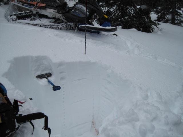
I only dug around mid elevation, north facing slope in Gold Hill and the pack looks quite consolidated and generally a nice progressive right side up snow pack. A couple layers that have some slightly weaker snow, but they did not appear to be a real concern at this location. I did not go hunting for much shallow, weak, sugary snow.
Comments
A fairly nice deep snow pack in this mid elevation north facing slope in Gold Hill, 60" of snow and generally a right side up snow pack with increasing densities to the ground.
Very manageable and shallow fresh wind slabs that would only crack and tumble downhill. These could be more connected and sensitive tomorrow with tonights wind and snow.
Periods of sun, light snow and gusty winds at times mad for some nice lighting.
Today's Observed Danger Rating
Moderate
Tomorrows Estimated Danger Rating
Moderate
Coordinates