
Observation Date
2/24/2019
Observer Name
Bill Nalli, Jason Boyer
Region
Uintas » Upper Weber Canyon
Location Name or Route
El Diablo-Big Cat Ridge
Comments
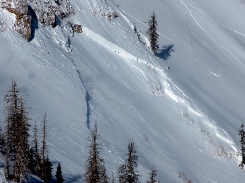
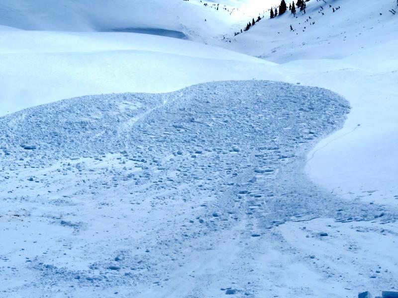
This slide in the upper part of Mill Fork in Chalk Creek is at 10,300', NE, 8' deep, 200' wide, 700' vert. It's another repeater which last ran late January and looks to have once again failed on the upper most layer of depth hoar that was not cleaned out during previous slides. This continues to be a theme with many of the large events in the Uintas this winter. Each event is failing at a deeply buried, relatively strong layer of facets but not eliminating them. Much weak snow remains in the bed surface and the combination of advanced facets and thin snowpack continues to provide the recipe for big delayed action avalanches.
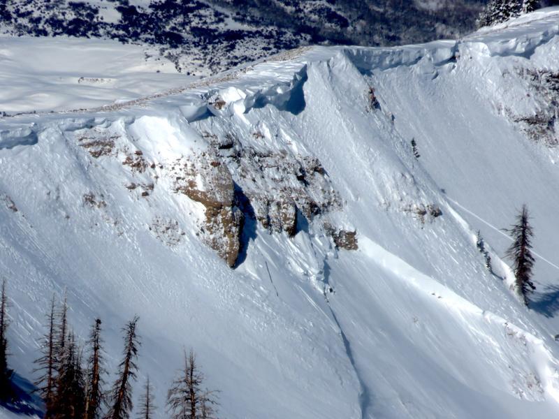
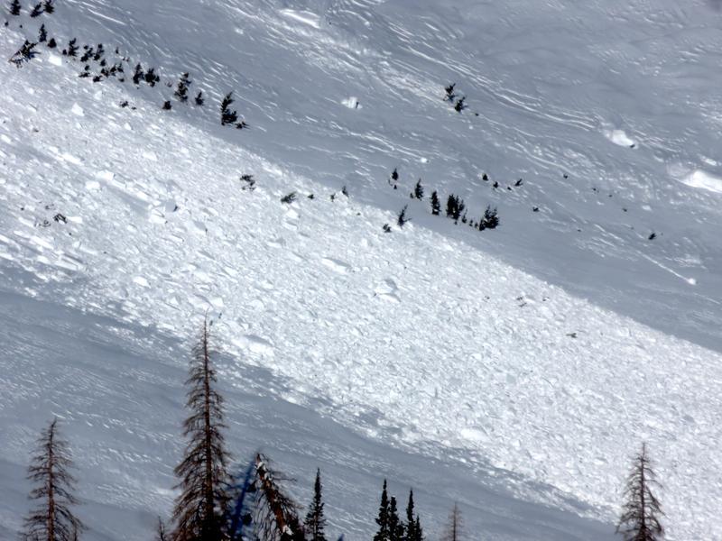
We are also still able to find areas where explosives can trigger something deep to near the ground. The theme is similar where a surface wind slab is the first to fail and then this larger trigger initiates the deeper slab. This D2 was triggered today with an air blast below a small cornice. S aspect, 10,500'.
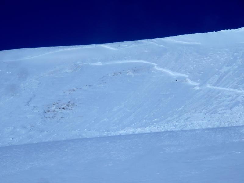
The structure in these two pits dug today highlights the problem. The pack is deep in many places but nearly all the upper elevation shady aspects has some form of weak snow near the ground. Some places are deep and have not avalanched. Others have and are thinner. We aren't sure whether we can trust either. It must be determined on a slope by slope basis. Stability tests are notoriously not much help with this type of situation. The weak layer is too deep for ECT's to be useful. PST's show results that indicate stability. It really is mostly stable unless you find the thin spot that can transfer the energy to the weak layer or you trigger a small wind slab that becomes the big trigger for the huge slide. Probability is low but the consequences are extremely high.
We performed a PST on the upper pit in Big Cat 6 and scored PST 180/200 (End) @44cm. Strong right?
What if the slope was steeper and a big cornice fell on it, like the above slide in Mill Fork? Or a sled gets stuck during a high mark?


Video
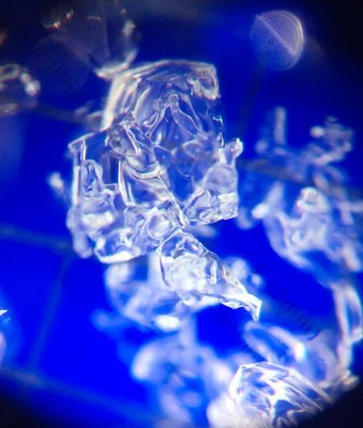
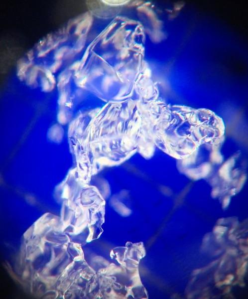
Close up of the layer in question shows advanced cup shaped depth hoar, some that have formed clusters or chains, that are showing signs of rounding and ultimately strengthening. The question is when will they be strong enough that we will feel good about them? Maybe not until they melt back into the water cycle this spring or summer.

Today's Observed Danger Rating
Moderate
Tomorrows Estimated Danger Rating
Considerable
Coordinates


