Observation: Park City Ridgeline

Observation Date
2/23/2019
Observer Name
Sean Zimmerman-Wall
Region
Salt Lake » Park City Ridgeline
Location Name or Route
PC Ridgeline
Avalanche Problem #1
Problem
Wind Drifted Snow
Trend
Same
Problem #1 Comments
Not sure why, but I cannot insert weather comments using my browser, so all info is here.
Clear skies gave way to graybird conditions. Cold temps and light to moderate West winds at mid elevation kept things frigid. Snow surface losing strength due to faceting intervals occurring during clear periods. Ski quality is good to very good on all aspects.
Wind slab issue observed from afar and through reports of our other team members seeing active transport. Did not spend very much time in the wind zone. Large cornices were also noted along Radar Love Bowl and the Montiors of the PC Ridgeline.
One sizeable Loose Dry was noted in No Name Bowl on steep East facing terrain. The slide ran over an existing skin track and could have been caused by someone walking the ridge. Inconsequential, but the distance it ran shows how weak the snow surface has become. Many tracks in No No Name with sluffs running off each turn in steep terrain.
Given current forecast and temp regime, the snow surface should continue to weaken and trace amounts of snow will keep the skiing good. If the storm door opens again, or we see some notable winds, these surface weaknesses could come into play. Stay vigilant, it is easy to get complacent with epic skiing and good stability.
Comments
No sweet turn photos here, guess I missed the Mark. Just some annotated photos of snowpack and avalanches from today.
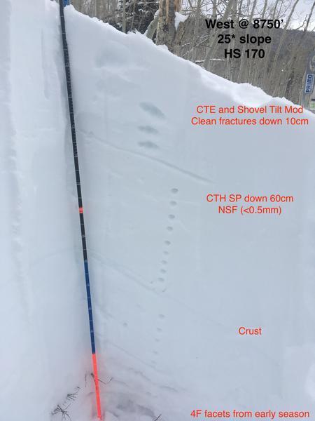
1. Snowpack on West Facing Limelight. Of note was the test results supporting loose dry issue. As well as crust buried over a meter on West facing. We did get repeatable results on a NSF layer down 60cm. This was a very fine grained layer that was hard to identify, but likely formed during a clear/cold spell in between the storms over the last two weeks.
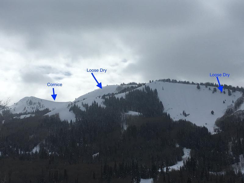
2. PC Ridgeline showing some of the activity and areas of concern.
Today's Observed Danger Rating
Moderate
Tomorrows Estimated Danger Rating
Moderate
Coordinates