Observation: North Fork Provo R.

Observation Date
2/15/2019
Observer Name
Hardesty, Woodruff (UDOT Provo Canyon)
Region
Provo » Provo Canyon » North Fork Provo R.
Location Name or Route
Sundance and Aspen Grove
Weather
Sky
Few
Wind Direction
Southwest
Wind Speed
Moderate
Snow Characteristics
New Snow Density
High
Snow Surface Conditions
Powder
Damp
Snow Characteristics Comments
Fast and surfy graupel skiing above 7500'; damp below (as per rain/snow line from yesterday). 23"/3.28" SWE since Wednesday.
Red Flags
Red Flags
Recent Avalanches
Wind Loading
Red Flags Comments
See below
Avalanche Problem #1
Problem
New Snow
Trend
Decreasing Danger
Problem #1 Comments
Perhaps a combination of storm snow and wind drifted snow. Many widely propagating soft slab avalanches (from yesterday) noted on easterly facing Bob's Knob (as reported this morning). These roughly similar band as noted in Butler Fork by Craig Gordon and others. Too much exposure to investigate crown - but based upon snow pits - imagine wind loaded 'graupel slabs' overlying lower density snow from Wednesday night. These avalanches perhaps 1-2' deep (up to 3' where wind loaded) and 700'+ wide, cleaning out the standard Bob's slidepaths by taking out immature aspens. (pics below). Other potential layering included what looked to be recrystallized graupel 60cm down though ECTX (elicited via pry-bar).
Control work with avalauncher this morning produced a good size 3+ avalanche 1-2' deep and 1000' wide on Ipanna face at 8400' east facing. This is outside of Sundance but threatens the resort from above. Pics below; likely similar layering as above.
Lost Creek natural from mid-morning as reported

Expect these to gradually stabilize depending on increased stress from this next storm.

Other concerns: health plumes of wind drifted snow noted along exposed ridgelines. Graupel pooling beneath cliffbands or at steep/less steep transitions should be anticipated.
Avalanche Problem #2
Problem
Wet Snow
Trend
Decreasing Danger
Problem #2 Comments
Plenty of wet loose sluffs noted below 7500' from rain/snow line. This should rapidly heal with tonight's cold front unless insulated by a larger amount of storm snow.
Comments
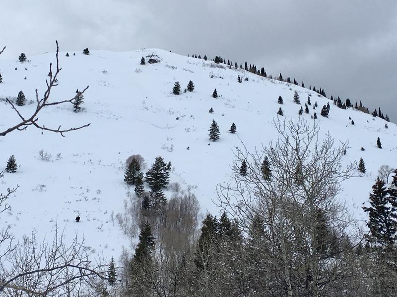
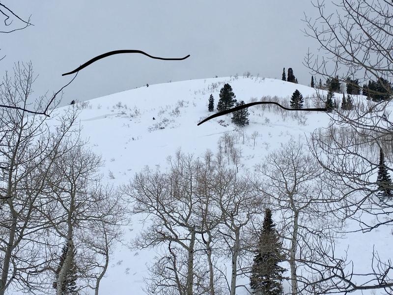
Pics: Thursday naturals on Bob's
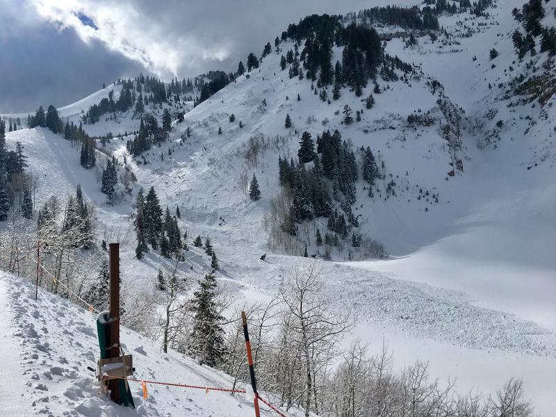
Explosive work on Ipanna face
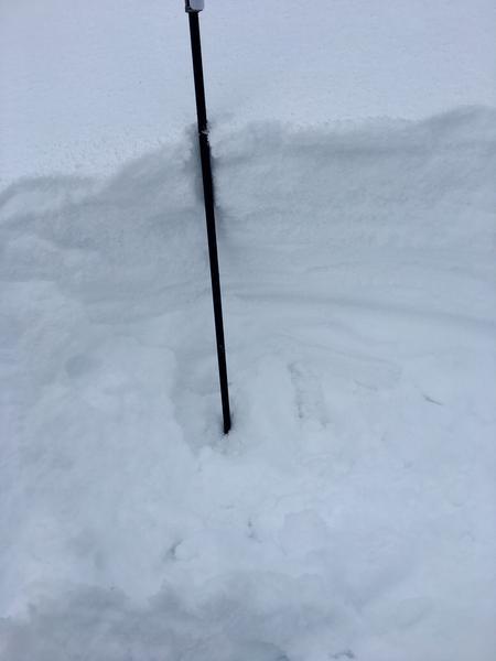
quick note of about 30cm of graupel above lower density snow earlier in the storm.
Today's Observed Danger Rating
Considerable
Tomorrows Estimated Danger Rating
None