Observation Date
2/4/2019
Observer Name
Tomasz Stefankowski, Nate Rockwood
Region
Salt Lake » Big Cottonwood Canyon » Bear Trap
Location Name or Route
Beartrap Fork
Red Flags
Red Flags
Wind Loading
Cracking
Poor Snowpack Structure
Avalanche Problem #1
Problem
Wind Drifted Snow
Trend
Increasing Danger
Problem #1 Comments
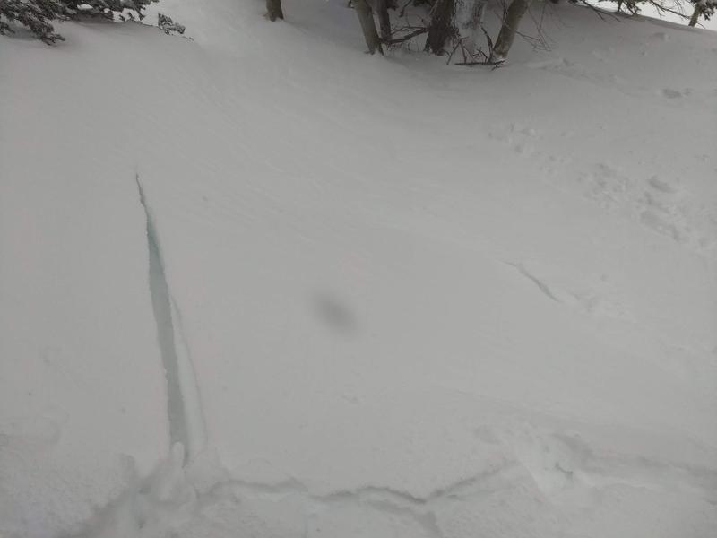
Due to recent snowfall and strong winds, reactive (yet not sensitive) wind slabs & cracking were observed while breaking trail (photo 1). Winds were prevalent today, especially on upper elevation ridges and open slopes, increasing the wind slab reactivity throughout the day. Lots of new snow available for transport, with small wind drifts and wind effected pockets found in the wider openings within the trees. Best skiing was found on mid elevation wind sheltered slopes.
Avalanche Problem #2
Problem
Wet Snow
Trend
Decreasing Danger
Problem #2 Comments
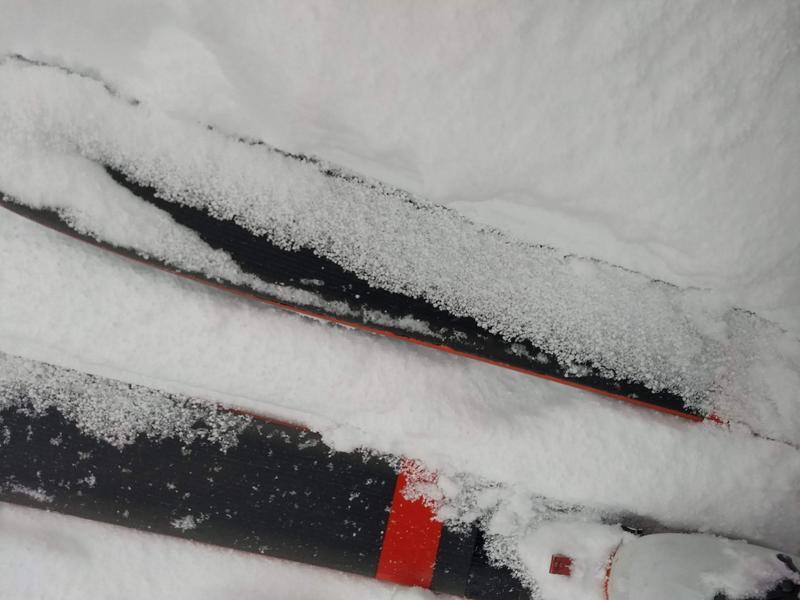
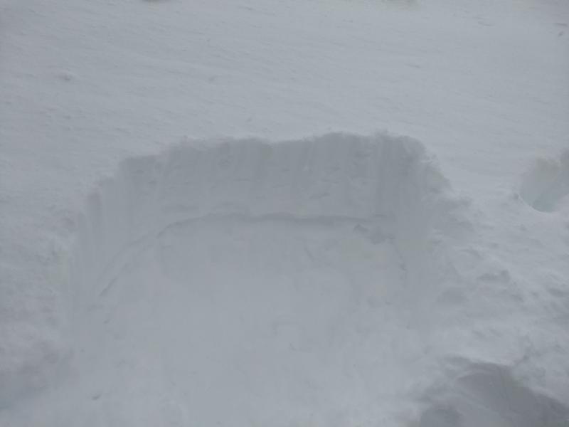
Started around 7,500' (close to rain-snow line) and did not see any wet activity at that elevation. Areas of rhime/rain & melt/freeze crusts crusts were observed under the new snow within first 1,000 feet of ascent on S-W terrain. Above 7,500' the new snow was dense and full of graupel (photo 2). The dense snow still provided supportable, creamy riding conditions, which became better throughout the day with colder temperatures and 2-4 inches of new snowfall. Occasional melt/freeze crust was felt in areas with wind scoured terrain (photo 3 showcasing the new storm snow on top of said crust). With temperatures predicted to continue dropping over the next couple of days hopefully the rain-snow line will drop back down as well.
Comments
Considerable danger may rise to high at upper elevations for wind loading, if the forecast is correct for the next 12-24 hrs of water weight / snow accumulation.
Today's Observed Danger Rating
Considerable
Tomorrows Estimated Danger Rating
Considerable
Coordinates