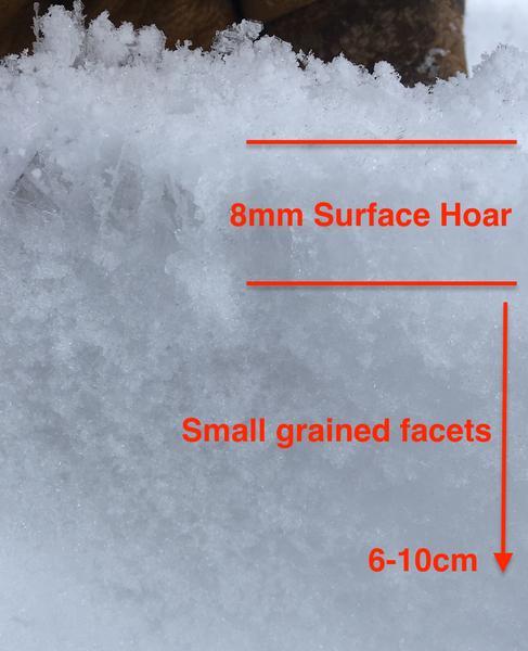
A mixed bag of snow surfaces. This was what the outing was all about today. A few days of high pressure both weakened the top few cms of snow but also deposited 1cm surface hoar in many areas, even along exposed ridgelines.
After today's weather, the snow surfaces will be highly variable ahead of tonight's storm. Plenty of the crops of surface hoar were blown away or laying over. When standing up, they - like stellars - are collapsible in nature and often result in remotely triggered slides with SH producing avalanches on very low slope angles. Whether or not the surface hoar has been removed, 5-10cm of diurnal facets exist on the snow surfaces. Overcast skies, warm temps and wind help to "soften" the edges of these surface facets but they should be presumed ready and willing to produce avalanches (with enough load) until proven innocent.
The off aspects that I looked at held a pencil to knife 3cm melt freeze crust with a few cm of faceted snow below. Variation in aspect and slope angle reduce the thickness and hardness of the crusts.
Bottom Line: The forecast snow and winds will certainly lead to natural and human triggered avalanches likely at the old snow surface and perhaps within the storm snow with remotely triggered slides possible in the northerly terrain; most pronounced in the sheltered shady terrain. Wet avalanches will be likely on northerly slopes at the rain/snow line and below. With enough water and wind, repeaters and odd areas (Lambs, No Name, Snake Creek, etc) may produce larger avalanches.