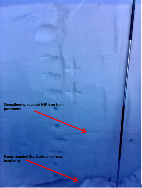
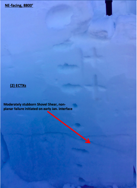
Dug on a NE face ~8800 ft. to look at mid-elevations and structure in thinner areas not completely hammered by wind. HSn 140 cm consisting of an 80 cm right-side-up storm(s) slab on top of healing older layered snow. At this interface the January facet layer has rounded and shows little weakness. Under this the bottom 60cm is rounded and has gained strength. The old basal facets are also rounded and damp with a refrozen ice layer on the ground. Overall no prominent weaknesses at this location and little evidence of the strong N winds below treeline and ridgelines.
At lower elevations, the melt-freeze crust from last weekend was noticeable under 3-4" of settled heavy powder.
Tests in these locations showed little, ECTX's and moderately stubborn shovel shears with rough non-planar failure on this interface 80cm down from the surface. While the higher alpine's hard wind slabs have shown the spatially variable ability to create deep, connected avalanches, the lesser of wind effect here with stronger layer interfaces makes for less chance of this kind of slide.
In my opinion this is a very low probability/high consequence time with specific trigger points needing sufficient force to pry out the deep, hard wind-affected storm(s) slabs. This is happening with large triggers (explosives, snowmobiles) in the greater UT backcountry but I think the chances of skier-triggers is lessening daily. That being said, I will stay away from wind-affected steep terrain and convex rollovers, rocky areas and unsupported slopes for some time now.