Observation: Moab

Observation Date
1/25/2019
Observer Name
Garcia, Matthews
Region
Moab
Location Name or Route
Laurel Highway, Gold Basin
Weather
Sky
Few
Wind Direction
North
Wind Speed
Light
Weather Comments
Cold and mostly sunny with light winds. While driving up we observed winds blowing out of the East loading high West faces. Mid day on top of Pre Laurel winds were light from the North.
Snow Characteristics
Snow Surface Conditions
Powder
Dense Loose
Melt-Freeze Crust
Snow Characteristics Comments
Still plenty of soft snow in sheltered terrain. South faces have been getting a lot of sun the past few days and now have a breakable sun crust.
Red Flags
Red Flags
Recent Avalanches
Wind Loading
Poor Snowpack Structure
Red Flags Comments
Natural avalanches are still happening. On our drive up we observed a new slide on the West face of Tuk No. This slide came down sometime between yesterday afternoon and this morning. The trigger appears to be wind loading. When we saw this slide, East winds were blowing snow plumes off the peaks and loading west facing slopes. There is still plenty of loose snow available for transport. We got some binoculars on this slide and it looks like it broke to the ground with an estimated 6 foot crown. We were about two miles away so it's hard to give an exact size. Later, we found poor snowpack structure in a pit on an Upper Elevation SW facing slope.
Avalanche Problem #1
Problem
Wind Drifted Snow
Trend
Same
Problem #1 Comments
Wind drifted snow continues to be a problem in the mid and upper elevations. Persistent weak layers are failing under the weight of wind deposited snow. This latest slide on the West Face of Tuk No is a prime example of how wind can overload a weak layer. We also encountered older, stiff wind slabs as we traveled across upper elevation SW and S facing slopes.
Avalanche Problem #2
Problem
Persistent Weak Layer
Trend
Same
Problem #2 Comments
Today we dug on a SW facing slope around 11,400 ft and found a poor snowpack structure. On the ground there was a thick knife hard crust. Large grained facets (up to 4mm) were sandwiched between this crust and the overlying slab. As we dug, these large facets literally fell out of the pit wall. Slope angle was about 25 degrees. A compression test failed on this facet layer (CT12 SC) and an ECT failed on this same layer (ECTP20). Watch the video below and you'll see the slab suddenly pop out after 20 taps. This pit site is similar in aspect and elevation to the slide we observed on Tuk No.
Later we moved to a South aspect around 11,500 ft and we expected to find a similar snowpack. To our surprise, the snow on a direct south face was much different. Total depth on this slope was 120cm. This pit showed relatively strong snow on top of 20cm of 1 - 2mm facets at the ground. Slope angle was 25 degrees. We conducted two ECT's with no failures. Compression tests showed resistant shears in the high 20's. I got a CT26 PC and a CT28 RP. Unfortunately, the snow on South faces has a breakable sun crust right now.
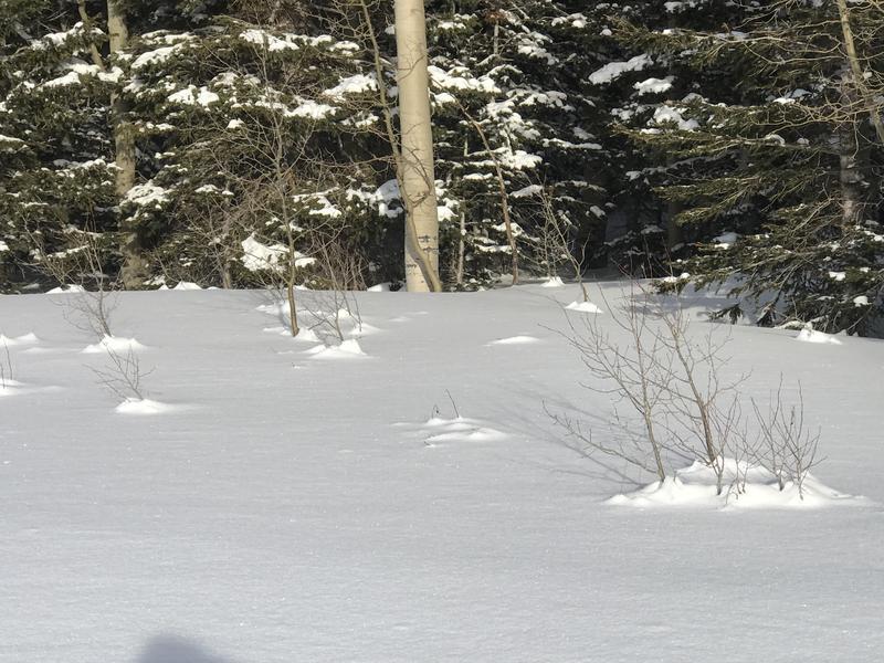
Surface hoar forming at low elevations and settlement cones.
Video
The video clip is from our pit on a SW aspect around 11,400 ft, 25 degree slope.
I agree 100% with the danger rose in today's bulletin. Considerable danger on upper elevation and on lee slopes. Moderate danger south facing and low elevation.
Today's Observed Danger Rating
Considerable
Tomorrows Estimated Danger Rating
Considerable