
Observation Date
12/29/2018
Observer Name
Gagne/Duvernay/Waikart
Region
Ogden » Snowbasin Backcountry
Location Name or Route
Snowbasin Periphery/Backcountry
Comments
Overall snowpack in Snowbasin backcountry looks good with no obvious persistent weaknesses. Wind slabs from Thursday's 24-hour east/northeast wind event were largely unreactive, but we were able to find a few small sensitive pockets. These wind slabs may remain sensitive as they are sitting on top of weak stellars from low-density snowfall this past week.
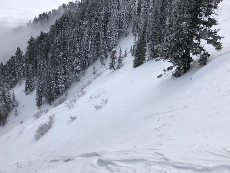
Photo below is of wind-scouring and pockets of wind drifts from 12/27 east/northeast wind event. This was on a mid-elevation slope that was exposed to the easterly winds.
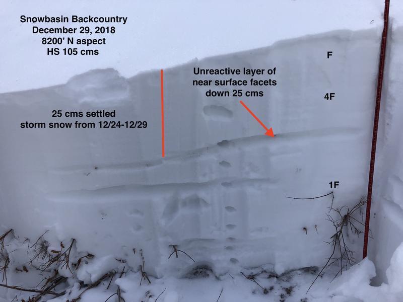
Lots of quick hand pits and pole probes to get a sense of the overall snowpack. This area lacks any weak snow from October, so no weaknesses down near the ground. We did find one layer of NSF down 25 cms from period of clear weather prior to stormy period commencing 12/24, but it was unreactive to stability tests with very poor quality shears. Photo below is typical of the snowpack in a wind-sheltered area above 8000'. It is right-side up as it moves from weaker, fist-hard snow down to 1F.
Overall hazard is mostly Low, with isolated areas of Moderate where there is recent wind-loading. Biggest concern for me is some of these wind drifts are sitting on top of weak stellars from low-density snow earlier this week, so they may stay reactive for another day or two.
Today's Observed Danger Rating
Moderate
Tomorrows Estimated Danger Rating
Moderate


