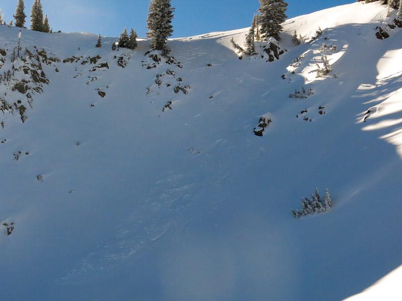
The wind has moved the upper elevation, light density snow onto the lee aspects and created the potential for shallow slabs or sluff avalanches. I saw one minor skier triggered avalanche off of a steep, north facing, wind loaded line at about 10,250' which had a slight crown to it and then sluffed a bit after two people skied it (see attached photo). I also triggered a rib of snow that had funneled off of a steeper rock face down by the Lake Mary Chutes that broke about 12" deep by 30' wide, but didn't run very far or pack any punch.
For the majority of the Central Wasatch, I think the avalanche danger is low, especially on mellower sub 38 degree slopes. On higher elevation slopes with more wind loading, I think the danger is moderate and will continue that way as long as it stays so cold. In the worst case scenarios, I think a determined skier could easily find a few wind loaded pockets in higher, open terrain (Red & White Baldy) where the danger is probably considerable, but that is not wide spread.
Unlike a week or so ago, the danger seems likely for triggering small pockets, but the consequences will be fairly low, except if the person gets swept off of a cliff.