Observation Date
12/28/2018
Observer Name
Greg Gagne with Dave Pease
Region
Salt Lake » Big Cottonwood Canyon » Mineral Fork
Location Name or Route
Mineral Fork
Weather
Sky
Clear
Wind Direction
East
Wind Speed
Calm
Weather Comments
Skies cleared to beautiful bluebird. Easterly winds rapidly diminished this morning, and were calm with a few light gusts.
Snow Characteristics
Snow Surface Conditions
Dense Loose
Wind Crust
Snow Characteristics Comments
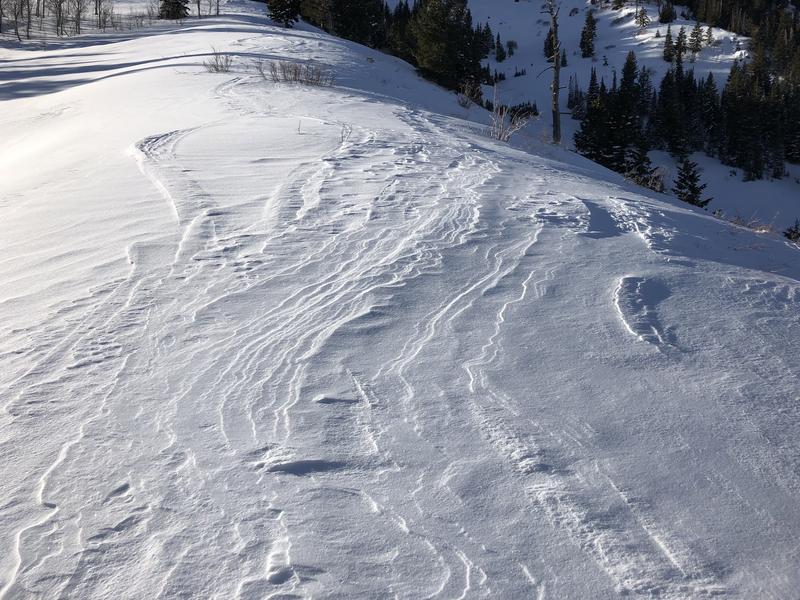
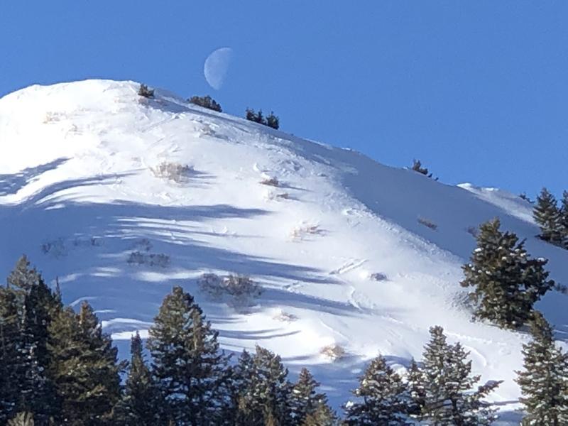
Winds yesterday and overnight clearly worked mid and upper elevation terrain in Mineral, with lots of evidence of cross-loading and wind erosion.
Red Flags
Red Flags
Recent Avalanches
Wind Loading
Poor Snowpack Structure
Red Flags Comments
Although we did not see any evidence of recent avalanches where we were traveling, I am aware of three wind slab avalanches that occurred today.
Avalanche Problem #1
Problem
Wind Drifted Snow
Trend
Decreasing Danger
Problem #1 Comments
Athough recent winds have been from the north, northeast, and east, there is definitely evidence of cross-loading, with drifts possible on all aspects. Most of the wind drifts we were finding below 9300' were shallow, but we were also finding pockets of hard fresh drifts up to 15 cms thick, sitting on top of the weak, very low-density snow that fell on Thursday and Friday. The wind slabs should relax somewhat by Saturday, but may still be reactive as they are on top of such weak snow.
Avalanche Problem #2
Problem
Persistent Weak Layer
Trend
Same
Problem #2 Comments
Have been looking at some thinner snowpack areas over this past week, and am finding several areas with weak, faceted snow underneath the storm snow that has fallen over this past week. Other than areas that had already avalanched (portions of Cardiac Bowl and Cardiac Ridge), I have been finding weak snow in the bottom 30-45 cms of the snowpack in thinner snowpack areas on aspects facing northwest through east. These thinner snowpack areas have likely been undergoing faceting over the recent 7-10 day period of colder conditions, leading to mid-pack facets above the October basal facets/depth hoar at the ground. In areas we were looking at today I could not identify a stronger slab on top of the weaker facets, but the weak structure is in place for possible future problems once the snowpack gets additional loading from wind and/or storm snow. (Our observation today definitely aligned with a
12/27 observation the UAC received.)
Snow Profile
Aspect
North
Elevation
9,100'
Comments
Video discussion of thinner snowpack area and how the poor structure may become problematic with a load on top.
Video
Although recent winds have been northwest through northeast, photos of wind erosion on southerly-facing ridge lines from terrain channeling which creates cross-loading on leeward aspects.
Today's Observed Danger Rating
Considerable
Tomorrows Estimated Danger Rating
Moderate