Observation Date
12/26/2018
Observer Name
Greg Gagne
Region
Salt Lake » Big Cottonwood Canyon » Cardiff Fork
Location Name or Route
Cardiff Fork / Cardiac Ridge
Comments
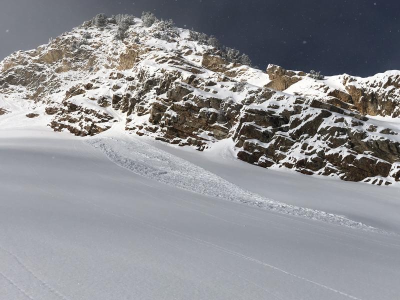
Very little wind affect in Cardiff Fork up to 10,500 on all aspects. Did see what could have been some cross-loading from NW winds on Little Superior Buttress. Few small cornices and denser slabs right at the ridges - these were sensitive, but very small. Their sensitivity indicated they could be an issue if there were larger drifts elsewhere.
On Tuesday I was finding the Christmas Day 5-10 cms to have bonded poorly with the existing snow surface of denser snow (with graupel) from Monday. I was getting very easy shears with shovel tilts, and long-running sluffs in steeper terrain. Was a bit suspicious that there may have been some near-surface faceting late in the day on Monday, Christmas Eve. But today was not identifying any issues with this old interface, and the only sensitivity was in the new storm snow.
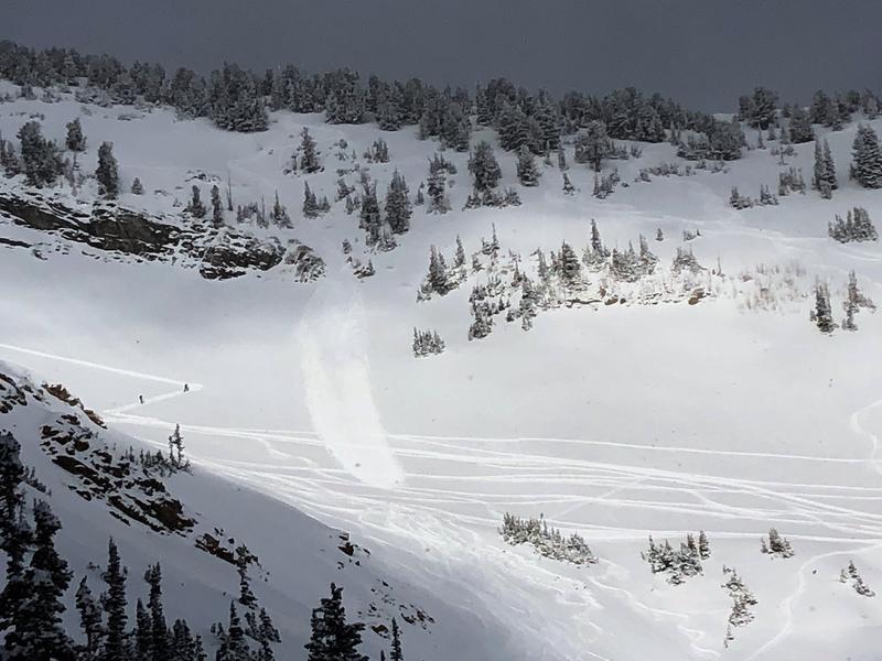
Photos below are of natural sluffs in Cardiff (there were quite a few, but these were all shallow with small debris piles) as well as the skier-triggered slide well down off of Flagstaff and Toledo Bowl.
More low-density snow in the forecast for Thursday, but not expecting large amounts (5-10 cms). Biggest concern will be any increase in the wind speeds which has plenty of loose, low-density snow available for transport.
Today's Observed Danger Rating
Moderate
Tomorrows Estimated Danger Rating
Moderate


