
Observation Date
12/21/2018
Observer Name
Staples, Rasmussen, Allred, Bennett, Fogg
Region
Logan » Franklin Basin » Boss Canyon
Location Name or Route
Boss Canyon
Comments
Spent much of the day looking at terrain and measuring slope angles and alpha angles.
Dug in one place, due north at 8600 feet.
95 cm of snow (about 3 feet)
5-10 cm of old, faceted snow at the ground.
ECTP24 and ECTP30+ (with a hard boot kick) - see photo below.

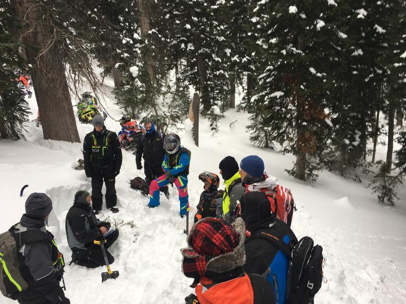
Image below is a graph of snow water equivalent (SWE) from the Tony Grove SNOTEL for the time period just before Thanksgiving until now.

We visited the location of a burial in Boss Canyon last year just after Christmas. Below is a graph of the SWE from Tony Grove SNOTEL from November and December last winter. The red line is the date of the accident. Notice that 3.7 inches of water fell just prior to that accident. This is a common occurrence to see accidents after huge loading events like that.

Danger was low where we traveled which was in the bottom of Boss and Steep Hollow Canyons.
Today's Observed Danger Rating
Low
Tomorrows Estimated Danger Rating
None
Coordinates


