Observation: Willows

Observation Date
12/2/2018
Observer Name
cmackenzie
Region
Salt Lake » Big Cottonwood Canyon » Willows
Location Name or Route
WIllow Heights/ PC Ridgeline
Weather
Sky
Overcast
Precipitation
Light Snowfall
Wind Speed
Light
Weather Comments
light snow. slightly rimed precip particles.
Snow Characteristics
New Snow Depth
5"
New Snow Density
Low
Snow Surface Conditions
Powder
Snow Characteristics Comments
Good skiing and riding conditions. New snow seemed to be bonding well despite layer of graupel at interface. Snow from thanksgiving storm actively faceting.
Red Flags
Red Flags
Collapsing
Poor Snowpack Structure
Red Flags Comments
was able to get audible collapses walking across undisturbed meadows.
Avalanche Problem #1
Problem
Persistent Weak Layer
Trend
Same
Problem #1 Comments
Very widely known poor structure on N-NE facing aspects and high elevations. Goal for today was to take a look at the more spatially variable snowpack on mid elevation NW aspect. Dug a few hasty pits and one full profile throughout upper willow heights and along the PC ridgeline all between 9.5k and 10k. Snowpack structure had the same weak basal facets even into western aspects. Able to get consistent ECTP failure at 21-22 on this layer. No natural activity observed on this layer but evidence of previous activity in the monitors on this layer. Potential for hazard to increase with additional loading.
Avalanche Problem #2
Problem
New Snow
Trend
Increasing Danger
Problem #2 Comments
Normal storm slab and dry loose caution. Potential to increase with additional load on observed graupel at interface.
Snow Profile
Aspect
Northwest
Elevation
9,800'
Slope Angle
17°
Video
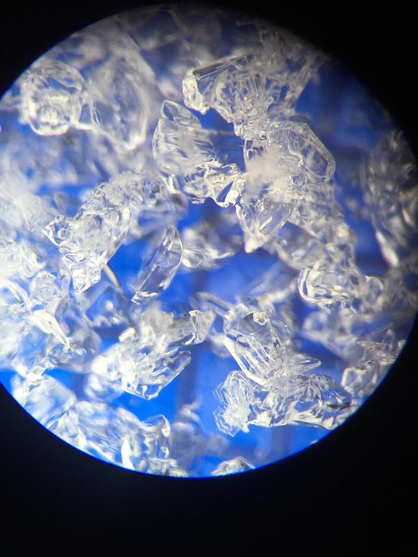
image of basal facets at 9.8k, nw aspect
Video
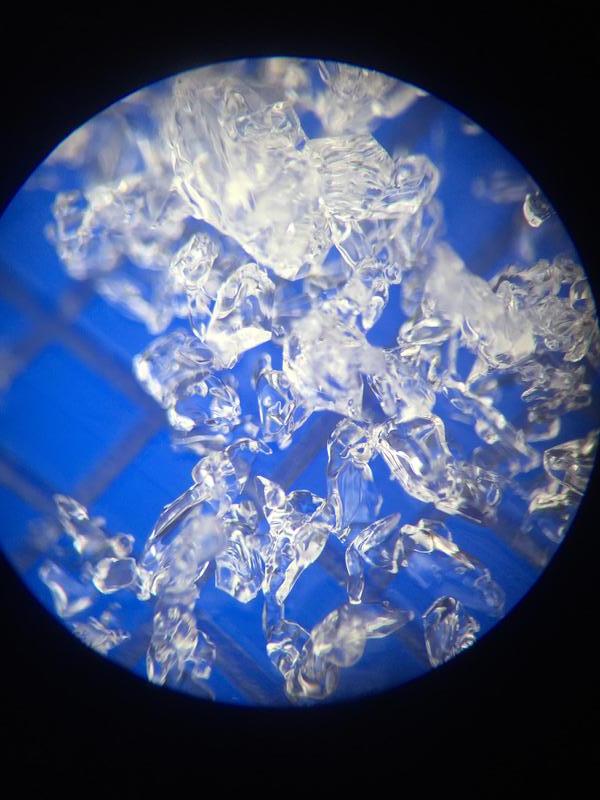
image of mid pack faceting in thanksgiving storm snow, 9.8k, nw aspect
Today's Observed Danger Rating
Considerable
Tomorrows Estimated Danger Rating
Considerable
Coordinates