Observation Date
11/30/2018
Observer Name
Brett Kobernik
Region
Skyline » Fairview Canyon
Location Name or Route
Fairview-Huntington Canyons
Comments
There's about a foot of snow from the Thanksgiving period of storms that is sitting on the ground or a small amount of older snow on the ground. This snow is fairly dense. Above that is a melt-freeze crust that formed early this week. On top of that is all the new snow since Wednesday. The dense snow from Thanksgiving coupled with the melt freeze crust is providing a fairly supportable snowpack. Easy traveling on skis and genuinely good ski conditions. This is about the perfect start to a snowpack. Very good stability in this type of terrain.
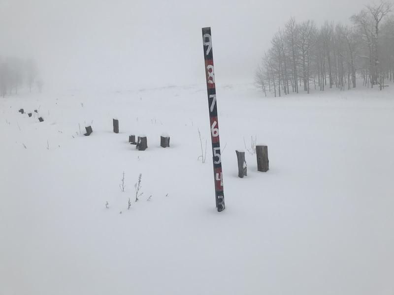
Generally there was about 2 feet of total snow across the top of Fairview Canyon over to the top of Huntington Canyon.
Photo below is a snow stake at the top of Fairview just along SR 31.
Surprisingly nice skiing.
Do not get this confused with higher north facing terrain where there is enough old sugary faceted snow from October and early November. I really don't have a good handle on what the stability is in the high north terrain with the new snow since Wednesday now adding weight to the buried weak snow. I do know that there was enough loose weak sugary faceted snow on those high north slopes to make me nervous. I should have some more info about this terrain soon. Until we can confirm that it's stable, you must treat it as suspect and avoid being on those steep slopes.

Really, the only potential avalanche danger is on the steep slopes above about 9500' that face northwest, north, and northeast. I would call it CONSIDERABLE avalanche danger. Outside of that terrain things are drastically different with a LOW avalanche danger.
I'm rating the avalanche danger based on the terrain I traveled in today.
Today's Observed Danger Rating
Low
Tomorrows Estimated Danger Rating
Moderate
Coordinates


